
 Versión en español
Ship Radar & Coast Explorer › Canary Islands and Costa Blanca, Spain
Canary Islands and Costa Blanca: diving, marinas and boat hire around your pin
In short (October 2026): Coast Explorer shows dive centres and dive sites, marinas, boat hire, boat fuel, boatyards and tackle shops on one dark map around your pin. On our map the Canary Islands have 80 dive centres and dive sites, 52 marinas, 84 slipways, 14 boat hire places and 13 boat fuel points. On the Costa Blanca there are 14 dive places and 22 marinas, and around the Mar Menor 16 marinas. These are OpenStreetMap data, including private places. Click any place for its details, what’s nearby, the nearest airport and the sea conditions at your pin.
Canary Islands: winter sun on the water
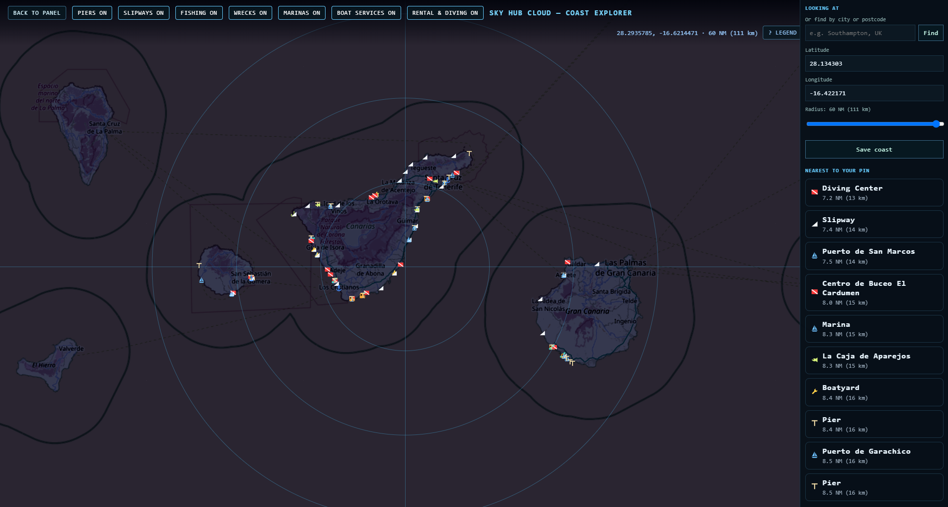
The Canaries are where the water stays warm in winter: on 15 October 2026 the card showed 24.7 °C off Los Cristianos and 24.6 °C off Mogán.
Diving in Tenerife south: Los Cristianos and Puerto Colón
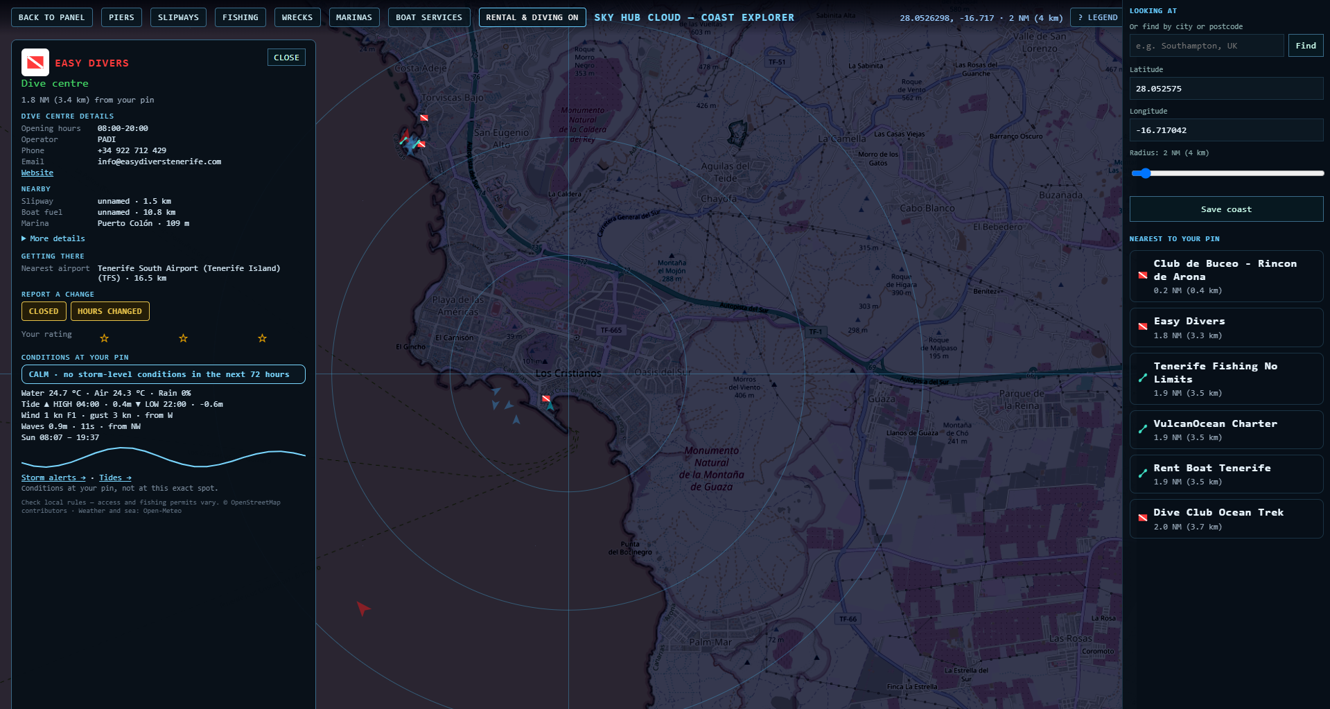
Around one pin in Los Cristianos the list shows Club de Buceo Rincón de Arona, Easy Divers and Dive Club Ocean Trek, plus boat hire at Rent Boat Tenerife, VulcanOcean Charter and Tenerife Fishing No Limits.
Tenerife east: Radazul
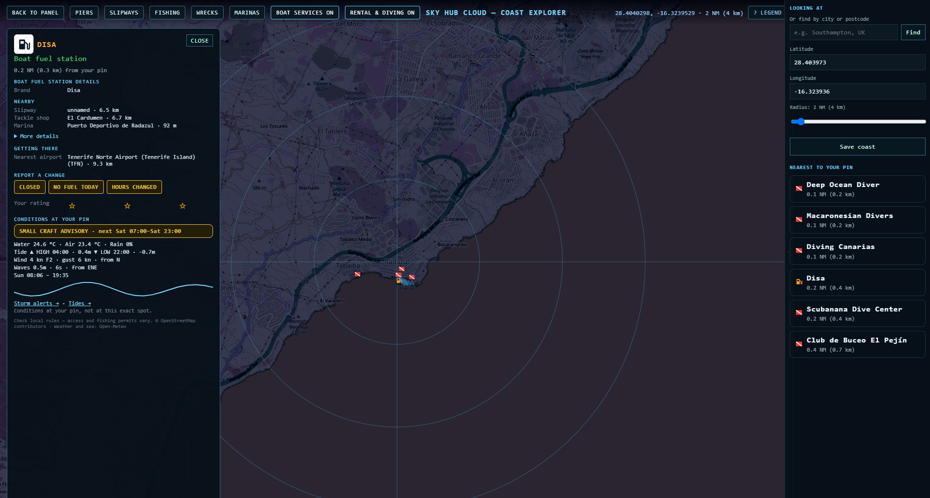
Five dive centres sit within 0.4 NM: Deep Ocean Diver, Macaronesian Divers, Diving Canarias, Scubanana Dive Center and Club de Buceo El Pejín. The nearest tackle shop on our map is El Cardumen.
Gran Canaria south: Puerto de Mogán
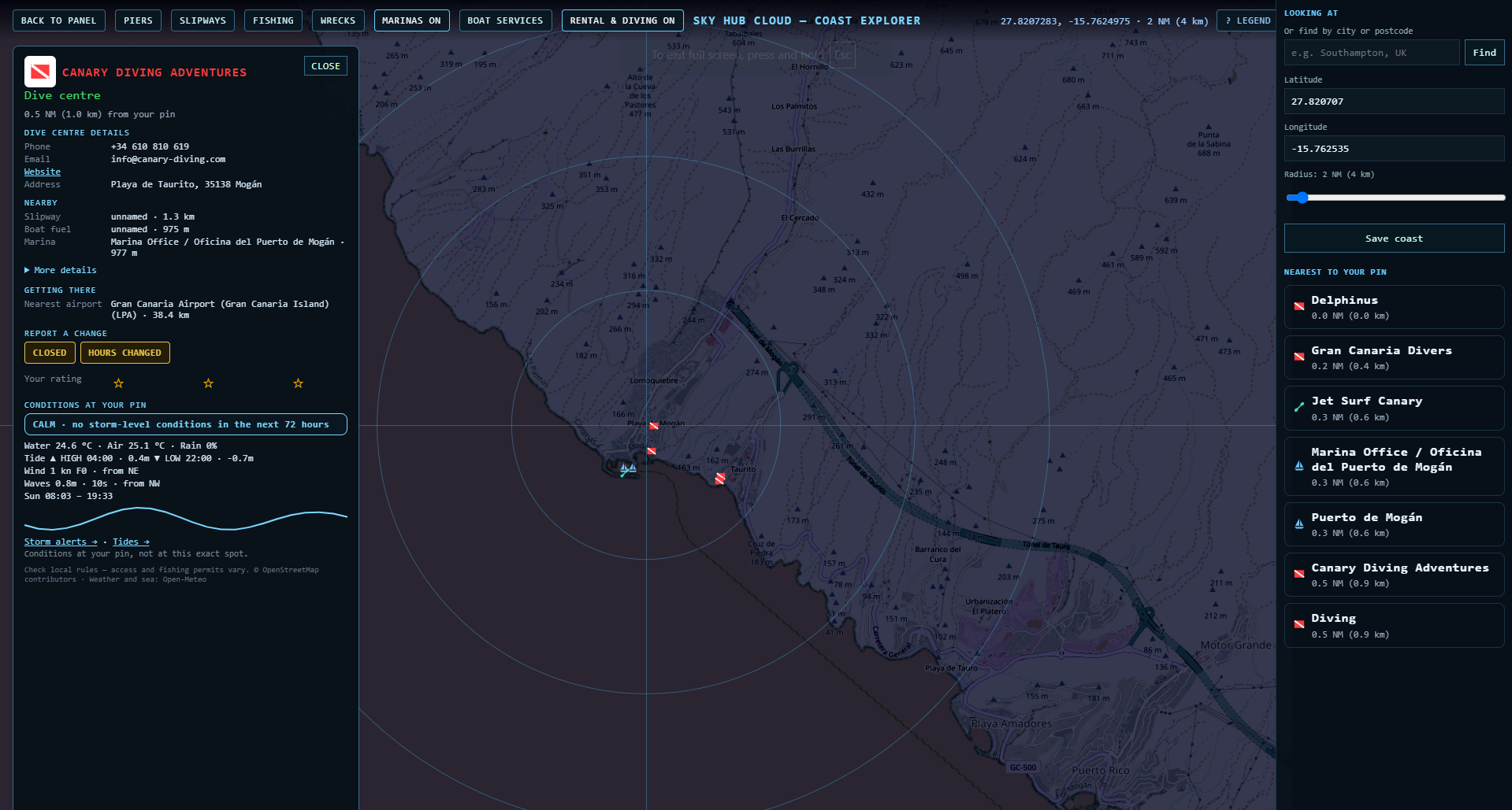
Close by: Delphinus, Gran Canaria Divers, Jet Surf Canary and the Puerto de Mogán marina. Towards Puerto Rico our map also lists Puerto Rico diving and Gran Canaria Water Sports.
Other islands on the map
Lanzarote: Puerto del Carmen dive sites, Lanzarote Dive Centre, Safari Diving and Puerto Calero marina with boat fuel. Fuerteventura: Marina Jandía and dive centres in Morro Jable. El Hierro: La Restinga with Buceo El Bajón, Arrecifal and Extra Divers.
Costa Blanca: Santa Pola — tackle, marina and the Tabarca ferry
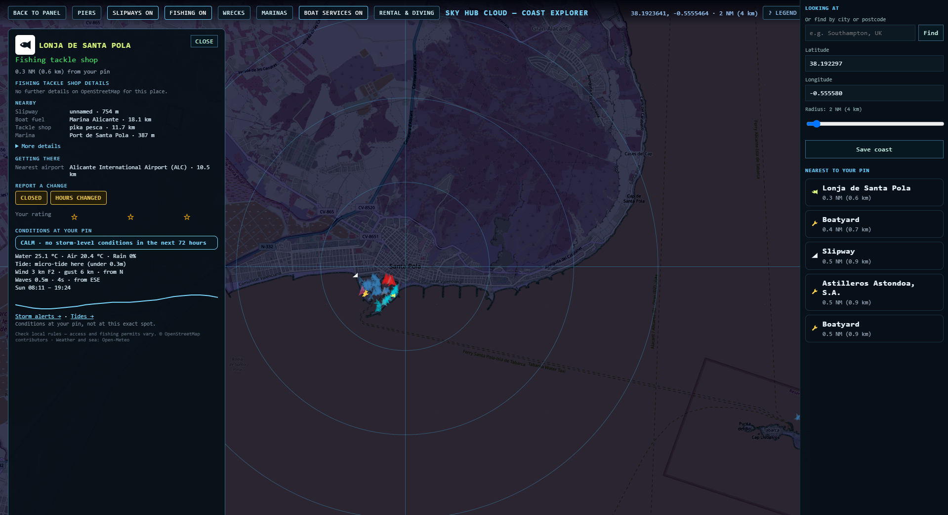
Nearby: Dive Academy Santa Pola and the Astilleros Astondoa boatyard. The nearest boat fuel on our map is at Marina Alicante, 18 km away.
Cabo de Palos: dive sites, a wreck and the marine reserve
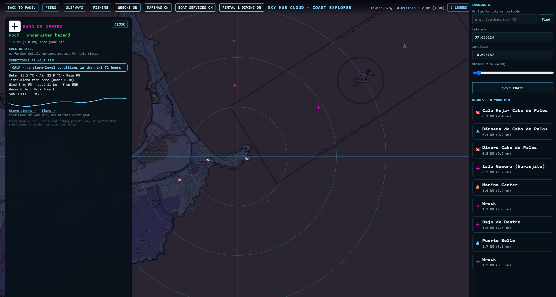
Diving inside the marine reserve has its own rules, so check them with your dive centre before you go.
Costa Blanca north and Mar Menor on our map
Costa Blanca north: Marina de Dénia, Real Club Náutico de Dénia, Club Náutico de Jávea and Club Náutico Moraira, dive centres such as Buceo Puerto Jávea and Scuba Moraira, and boat fuel in Dénia. Mar Menor: clubs and marinas at Lo Pagán, Los Nietos, Mar de Cristal, Islas Menores, Urrutias and Tomás Maestre.
Questions
Where can I dive in Tenerife south?
Around Los Cristianos and Puerto Colón our map shows Easy Divers, Club de Buceo Rincón de Arona and Dive Club Ocean Trek, and at Radazul five more dive centres.
Is the water warm enough to dive in winter?
The card shows the water temperature at your pin. On 15 October 2026 it was 24.7 °C off Los Cristianos.
Where can I hire a boat in Tenerife?
Rent Boat Tenerife, VulcanOcean Charter and Tenerife Fishing No Limits are on our map near Los Cristianos.
Where can I dive at Cabo de Palos?
The map shows the Cala Roja dive site, Divers Cabo de Palos and the Naranjito wreck, inside the area of the Cabo de Palos and Islas Hormigas marine reserve.
Where is boat fuel in Tenerife?
There is a Disa boat fuel station at Puerto Deportivo de Radazul. Every card shows the nearest boat fuel.
Can I check if a boat ramp is closed today?
Members report closures and changes in one tap, and other members confirm them, so the place card shows what boaters saw recently. Always check on site.
Do I need a fishing licence?
Yes, in most places you do. Coast Explorer does not issue licences; check official sources before you fish.
Place data © OpenStreetMap contributors. Weather and sea: Open-Meteo. Not for navigation.
Also on Coast Explorer: Gold Coast → · Sydney → · Malta → · Florida Keys →