
 Verżjoni bil-Malti
Ship Radar & Coast Explorer › Malta, Gozo and Comino
Malta, Gozo and Comino – dive sites, wrecks, slipways and marinas around your pin
In short: Sky Hub Cloud Coast Explorer shows 88 dive points (sites and dive centres), wrecks including Um El Faroud, P29, P31 and the Xatt l-Aħmar wrecks off Gozo, 112 slipways, 11 marinas and 3 boat fuel points on one map around the pin you set. Click any place to see its details, what is nearby, the nearest airport and the sea conditions at your pin.
What's on the map in Malta
OpenStreetMap data, including some private places.
| Layer | Places |
|---|---|
| Dive sites and dive centres | 88 |
| Slipways | 112 |
| Jetties and piers | 133 |
| Marinas | 11 |
| Boatyards and boat shops | 26 |
| Fishing tackle shops | 6 |
| Boat rental | 5 |
| Boat fuel | 3 |
The whole of Malta, Gozo and Comino from one pin
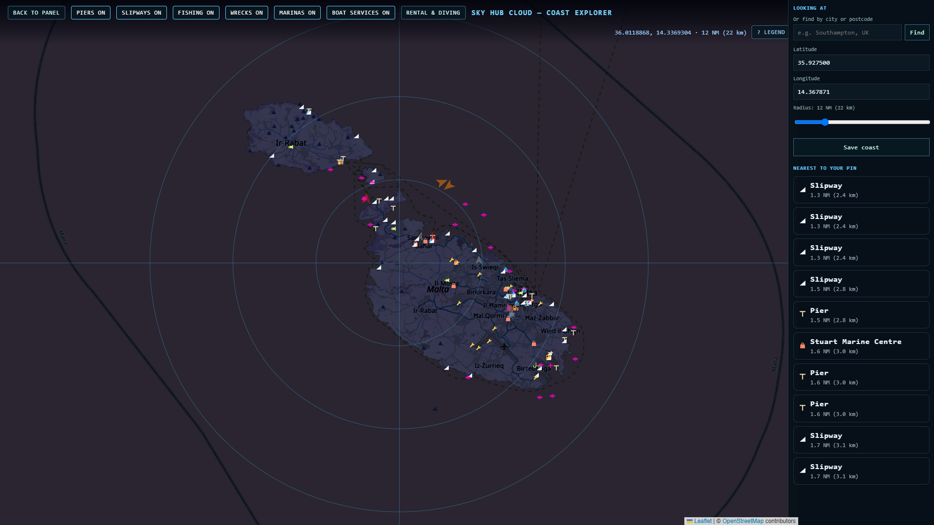
One wide pin covers all three islands. The dive sites cluster around Ċirkewwa, Comino and Gozo; marinas and boat services sit around Marsamxett and Grand Harbour.
Comino and Ċirkewwa – wrecks
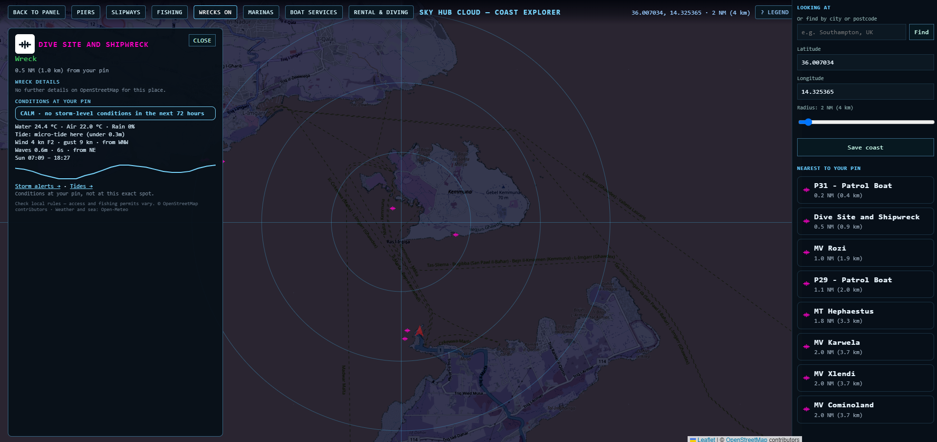
With WRECKS on, the wrecks around Comino and the Gozo channel are listed by distance: P31 patrol boat, P29 patrol boat, MV Rozi, MT Hephaestus, MV Karwela, MV Xlendi and MV Cominoland.
Comino and Ċirkewwa – dive sites
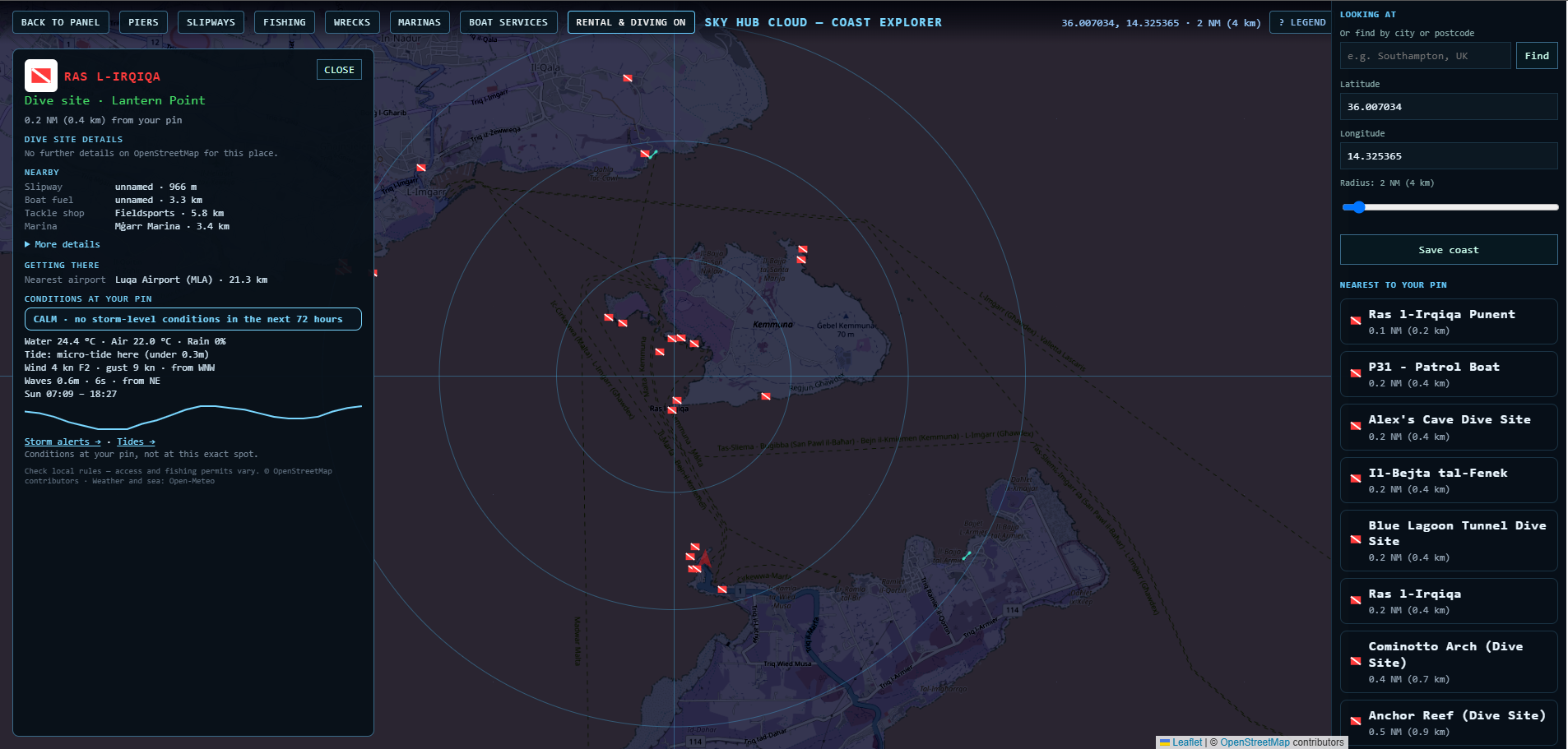
With RENTAL & DIVING on, the Comino side shows Ras l-Irqiqa, Alex's Cave, Il-Bejta tal-Fenek, the Blue Lagoon Tunnel, Cominotto Arch and Anchor Reef. The card for Ras l-Irqiqa lists the nearest slipway (966 m), Mġarr Marina (3.4 km), the nearest tackle shop and Luqa Airport (MLA).
Gozo – Marsalforn and Xwejni
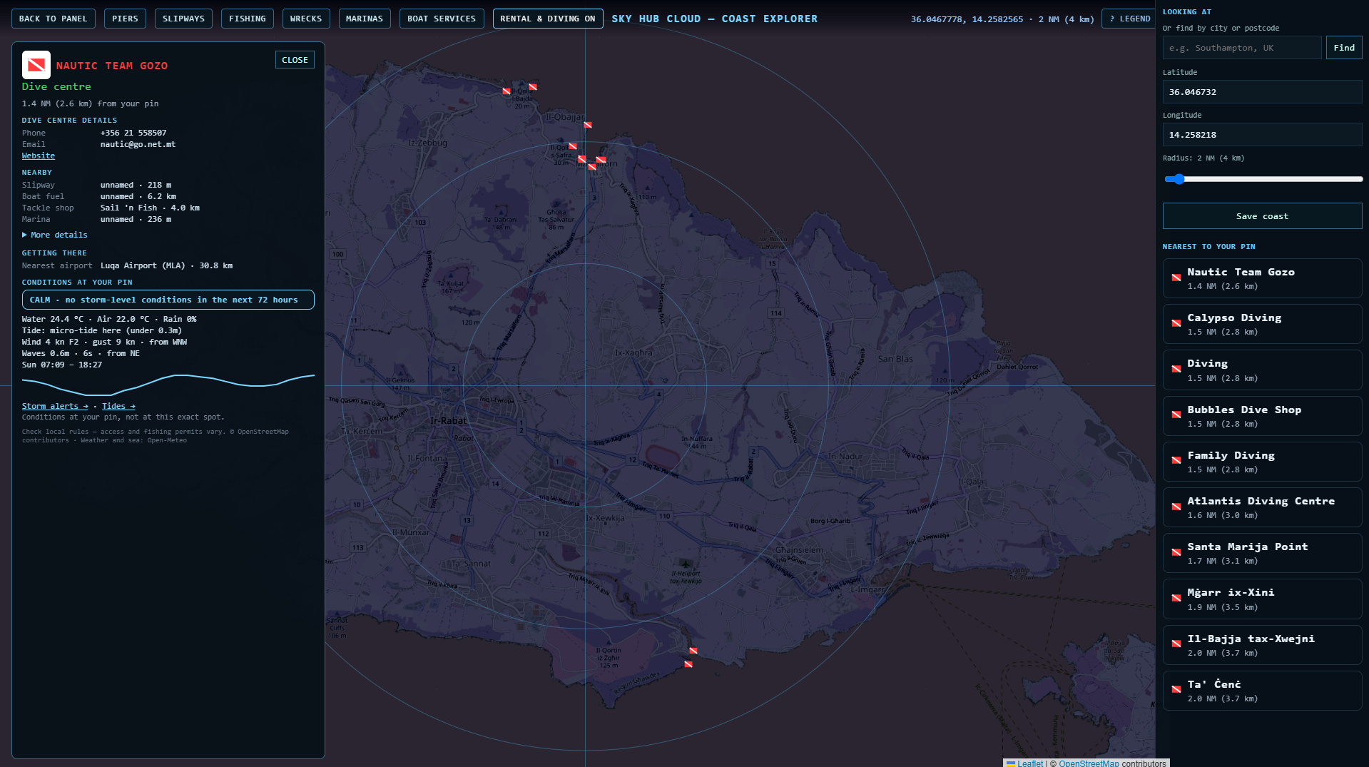
The north coast of Gozo has dive centres and sites close together: Nautic Team Gozo, Calypso Diving, Bubbles Dive Shop, Atlantis Diving Centre, Santa Marija Point and Il-Bajja tax-Xwejni. Where OpenStreetMap has them, the card shows a dive centre's phone, email and website.
Marsamxett and Grand Harbour – boat services
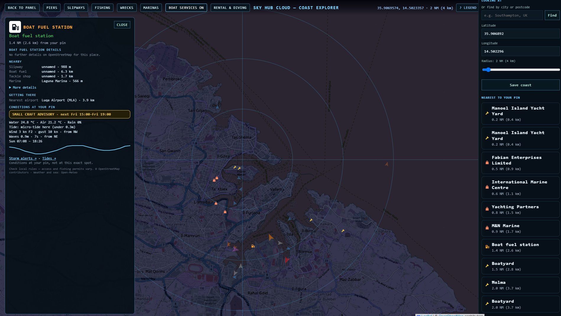
The busiest boating area: Manoel Island Yacht Marina and Yacht Yard, Laguna, Sa Maison and Excelsior marinas, boat shops, boatyards and a boat fuel station. The fuel station card shows the nearest marina (Laguna Marina, 566 m) and Luqa Airport.
Żurrieq – Um El Faroud
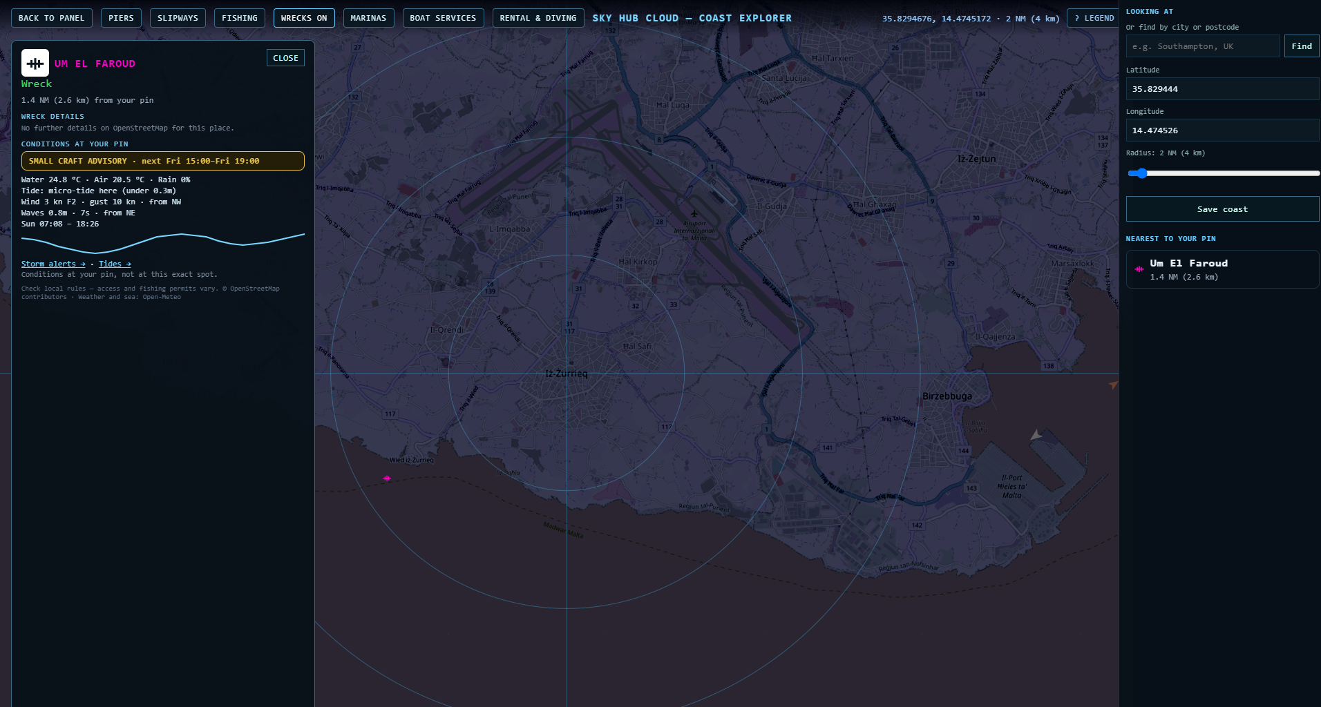
Um El Faroud, Malta's best-known wreck dive, lies off Wied iż-Żurrieq on the south coast. Set your pin nearby and the card shows its distance from you and the sea conditions at your pin.
Sea conditions in the card
Every place card ends with the conditions at your pin: water and air temperature, wind, waves, sunrise and sunset, a 72-hour storm check (for example “Calm” or “Small craft advisory”) and the tide. Malta has a micro-tide (under 0.3 m), and the card says so.
Good to know
The data comes from OpenStreetMap. Some places are private, and some slipways have no name.
Check local rules before you dive or launch: some areas, such as marine parks, have their own restrictions.
Sky Hub Cloud is not for navigation or dive planning. Always check with your dive centre and official sources.
Questions
Is there a map of Malta's dive sites?
Yes. Coast Explorer shows 88 dive sites and dive centres across Malta, Gozo and Comino around your pin.
Where are the wrecks around Gozo and Comino?
With WRECKS on, you'll see P29, P31, MV Rozi, MT Hephaestus and the Xatt l-Aħmar wrecks (Karwela, Xlendi, Cominoland), each with its distance from your pin.
Where is Um El Faroud?
Off Wied iż-Żurrieq on Malta's south coast.
Where can I get boat fuel in Malta?
There are 3 boat fuel points on the map. Each place card also shows the nearest boat fuel.
Are there slipways in Malta?
Yes, 112 slipways are on the map, most of them without a name in OpenStreetMap.
Can I check if a boat ramp is closed today?
Members report closures and changes in one tap, and other members confirm them, so the place card shows what boaters saw recently. Always check on site.
Place data © OpenStreetMap contributors. Weather and sea: Open-Meteo. Not for navigation.
Also on Coast Explorer: Gold Coast → · Sydney → · Florida Keys → · Spain →