
Ship Radar & Coast Explorer › Gold Coast, Australia
Gold Coast boat ramps, jetties and marinas — map around your pin
In short (October 2026): Sky Hub Cloud Coast Explorer maps 86 boat ramps, 559 jetties and pontoons, 22 marinas and harbours, 20 boatyards and boat shops, 7 fishing spots and 4 bait & tackle shops on the Gold Coast and Tweed Heads, from OpenStreetMap. Click a place and the card shows its details, the nearest boat ramp, marina and tackle shop, the nearest airport, and the tide, wind and waves at your pin. Built for boaties and anglers: find a ramp, a jetty or a bait and tackle shop before you hitch up the trailer.
Where are the boat ramps on the Gold Coast?
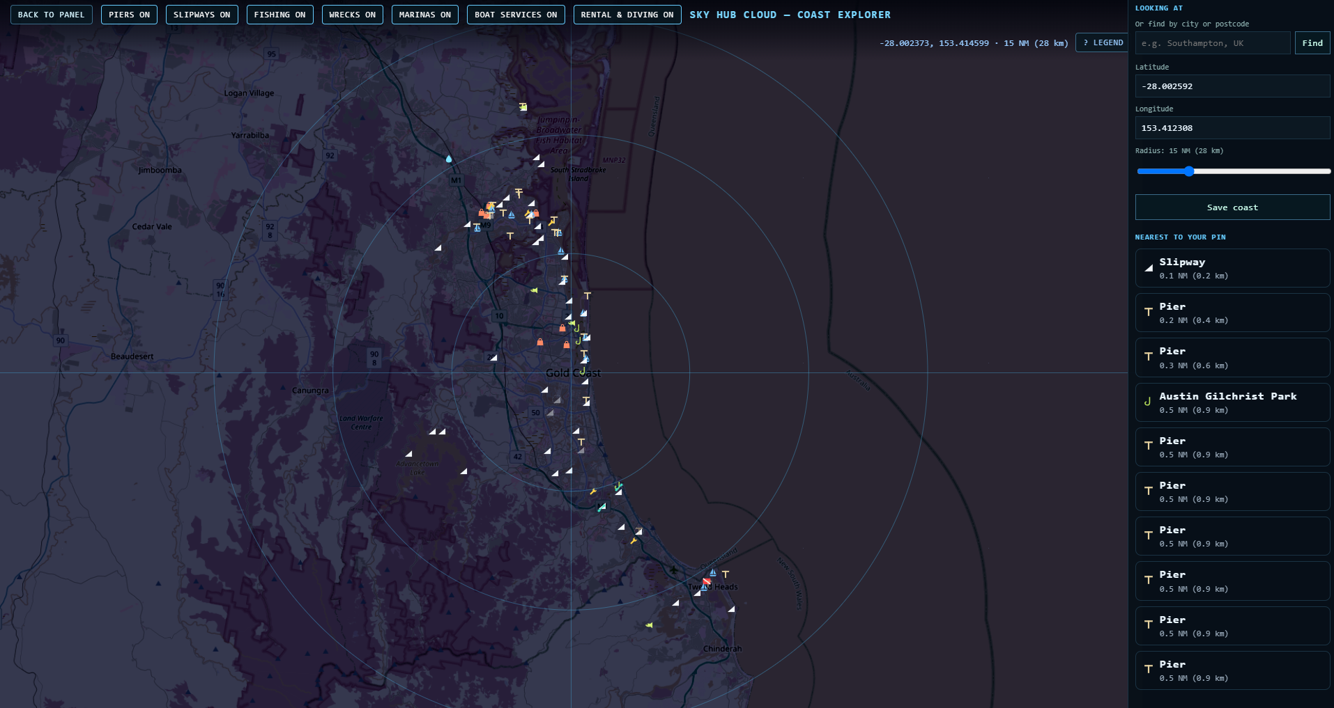
Named boat ramps on our map:
| Boat ramp | Suburb |
|---|---|
| Loders Creek Public Boat Ramp | Labrador |
| Isle of Capri Public Boat Ramp | Surfers Paradise |
| T E Peters Drive Boat Ramp | Broadbeach Waters |
| Carrara Boat Ramp | Carrara |
| Nerang Boat Ramp | Nerang |
| Colman Road Reserve | Coomera |
| Horizon Shores | Steiglitz (near Jacobs Well) |
| Thrower Drive Boat Ramp | Palm Beach |
| Winders Park Boat Ramp | Currumbin |
70 more ramps on the map have no name in OpenStreetMap. Turn on the boat ramp layer (the SLIPWAYS button on the map) to see them all. Names are as in OpenStreetMap; we call a ramp “public” only where its name says so.
Boat ramps on the Broadwater: Southport, Labrador and Main Beach
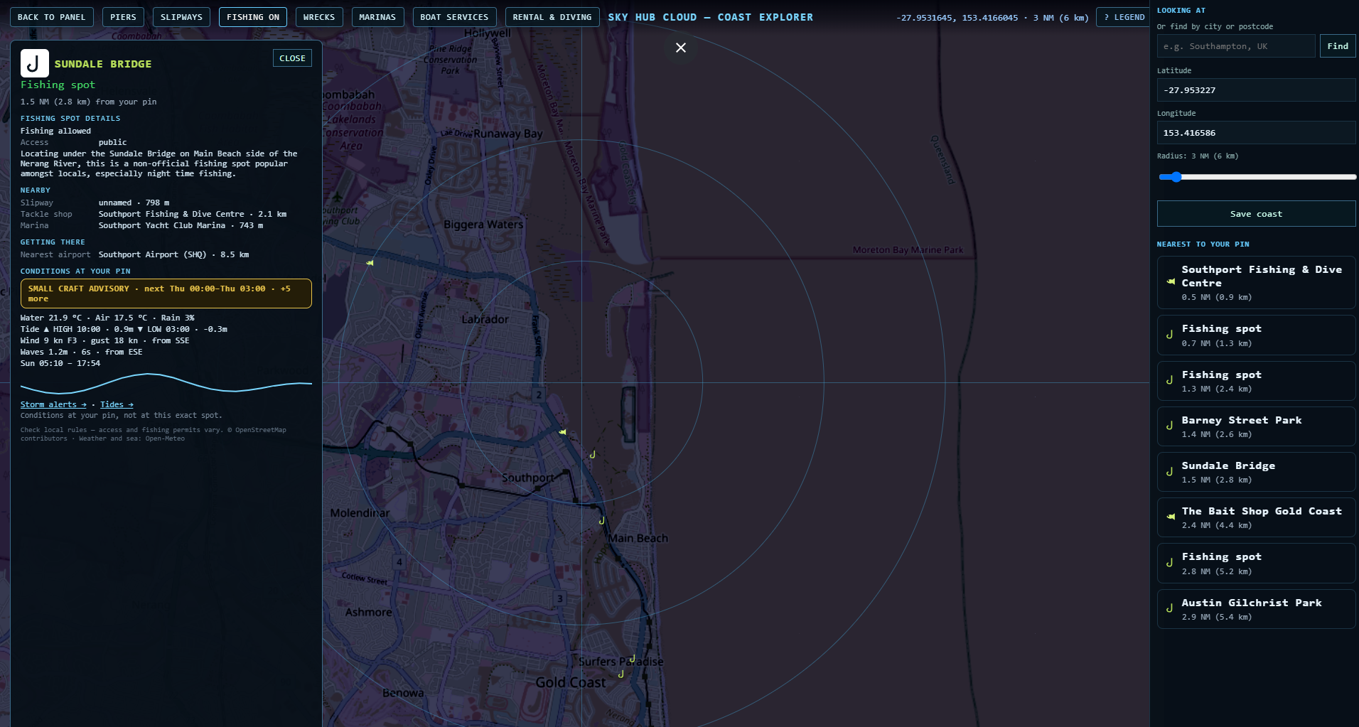
Loders Creek Public Boat Ramp in Labrador, and a boat ramp on The Spit next to Marine Rescue Southport on Muriel Henchman Drive. Around them: Broadwater Parklands Pier, Marina Mirage, Mariner's Cove Marina, Southport Yacht Club Marina, and fishing spots at Sundale Bridge and Barney Street Park. The nearest tackle shop is Southport Fishing & Dive Centre.
Northern Gold Coast: Jacobs Well, Coomera and Hope Island
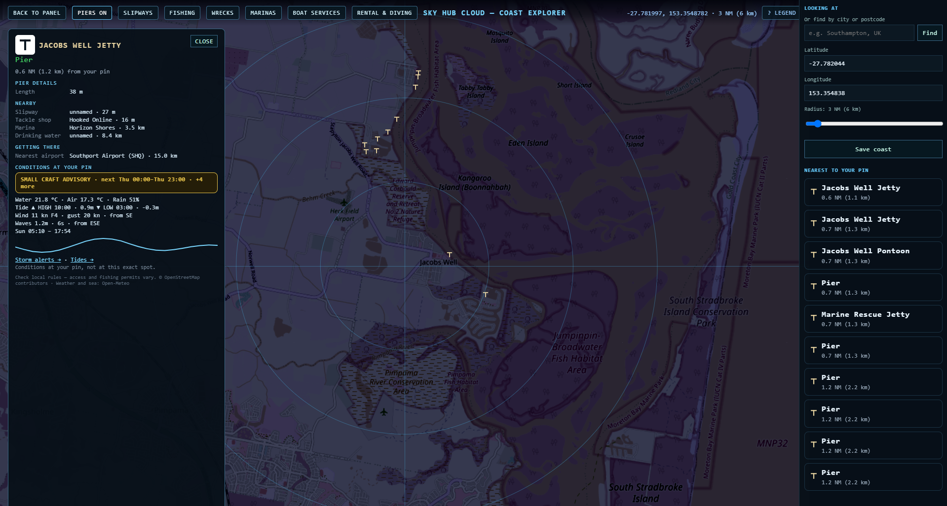
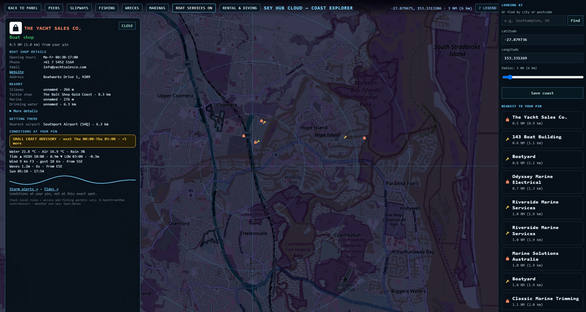
Jacobs Well Jetty, Jacobs Well Pontoon and the Marine Rescue Jetty, with Horizon Shores and Cabbage Tree Point Boat Ramp nearby and a tackle shop right at the jetty. Further south, the Coomera and Hope Island marine precinct: Gold Coast City Marina, Hope Harbour Marina, Cova Marina and Moorings On Coomera, with boatyards and boat shops such as The Yacht Sales Co., Riverside Marine Services and Odyssey Marine Electrical. Opening hours, phone and website are shown when OpenStreetMap has them.
Paradise Point and Runaway Bay
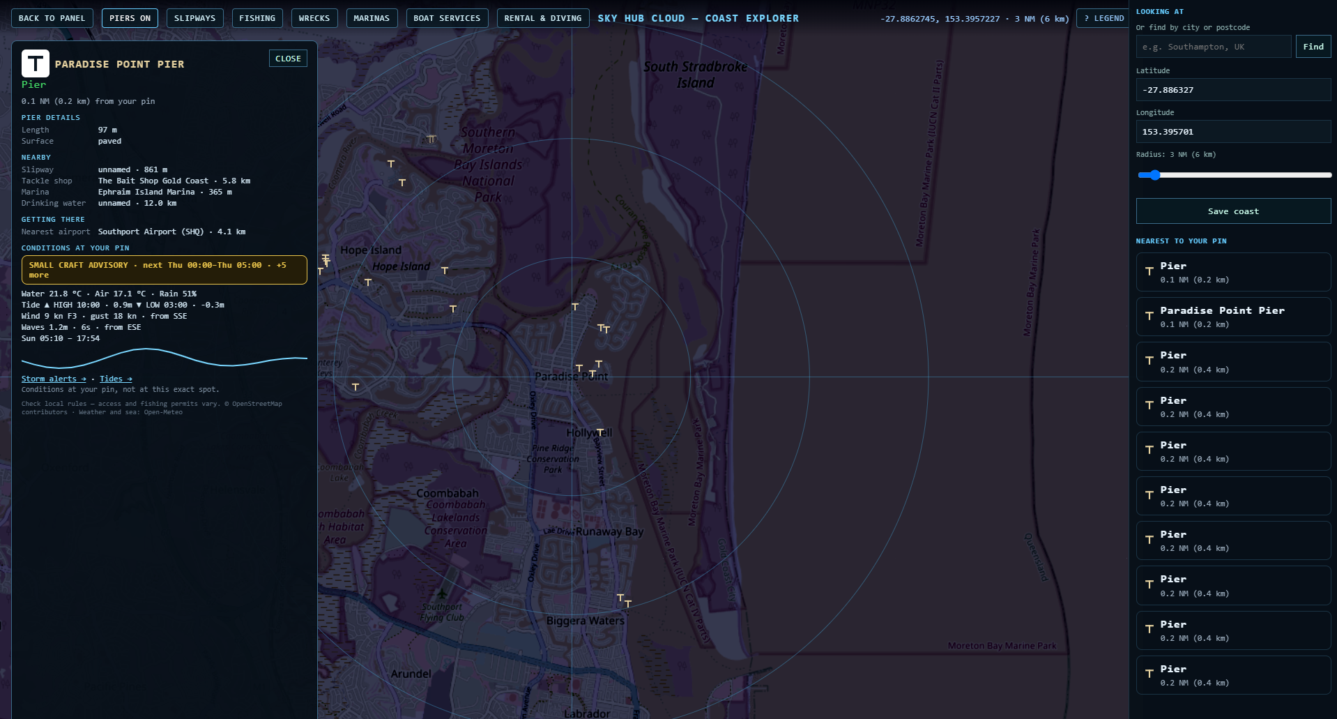
Paradise Point Pier (97 m, paved), with Ephraim Island Marina, Salacia Marina, AMT Marine and Runaway Bay Marina close by.
Southern Gold Coast: Palm Beach and Currumbin
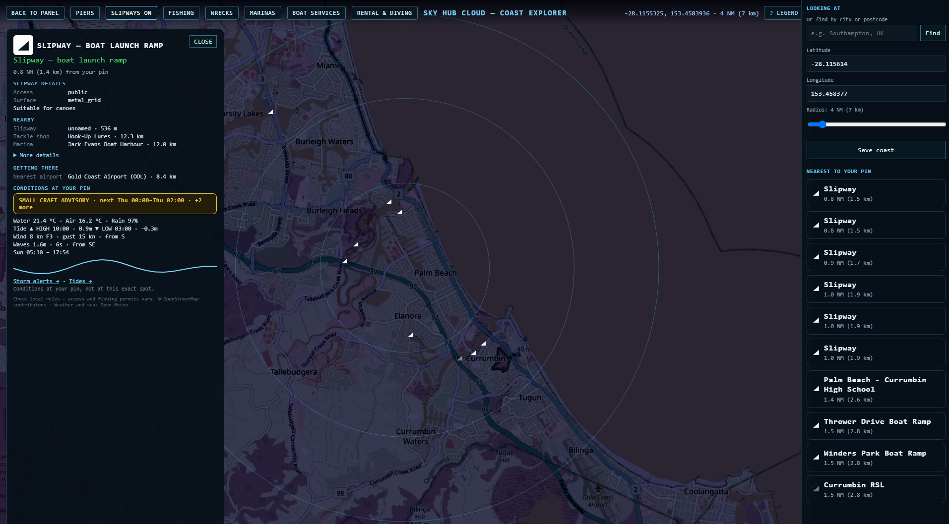
Thrower Drive Boat Ramp in Palm Beach, Winders Park Boat Ramp in Currumbin and other ramps nearby. Gold Coast Airport (OOL) is about 8 km from these ramps.
Jetty and pier fishing on the Gold Coast
Named jetties on our map: Paradise Point Pier, Broadwater Parklands Pier, Jacobs Well Jetty, Marine Stadium Jetty and the Sand Bypass Jetty on The Spit, known as the sand pumping jetty. The sand pumping jetty is a working platform that Gold Coast Waterways Authority closes to the public during pumping, maintenance and bad weather, so check GCWA before you go. Named fishing spots: Sundale Bridge, Barney Street Park and Austin Gilchrist Park.
Marinas on the Gold Coast
| Marina | Suburb |
|---|---|
| Marina Mirage, Mariner's Cove Marina, Southport Yacht Club Marina, Imperial Hotel Gold Coast Marina | Main Beach |
| Runaway Bay Marina | Hollywell |
| Salacia Marina, Ephraim Island Marina, AMT Marine | Paradise Point |
| Hope Harbour Marina, Cova Marina | Hope Island |
| Gold Coast City Marina | Coomera |
| Moorings On Coomera | Helensvale |
| Jack Evans Boat Harbour, Ivory Waterside Marina | Tweed Heads (NSW) |
Bait and tackle shops
The Bait Shop Gold Coast, Southport Fishing & Dive Centre, Hook-Up Lures and Hooked Online at Jacobs Well. Every place card shows the nearest one with its distance.
Tides, wind and waves at your boat ramp
At the bottom of every card: storm outlook, water and air temperature, tide times, wind, waves, sunrise and sunset at your pin, from Open-Meteo. Not for navigation.
Before you fish
Part of the Gold Coast Broadwater lies inside the Moreton Bay Marine Park. Fishing is not allowed in its green zones, and our map does not show the zones, so check the official Marine Parks zoning before you fish.
Questions
Is there a map of Gold Coast boat ramps?
Yes. Coast Explorer shows 86 boat ramps between Jacobs Well and Tweed Heads around your pin, with the nearest marina, tackle shop and airport for each.
Where are the public boat ramps on the Broadwater?
Loders Creek Public Boat Ramp (Labrador) and Isle of Capri Public Boat Ramp (Surfers Paradise) carry “public” in their name. There is also a ramp on The Spit next to Marine Rescue Southport.
Where can I go jetty fishing on the Gold Coast?
Paradise Point Pier, Broadwater Parklands Pier, Jacobs Well Jetty and the sand pumping jetty on The Spit (often closed by GCWA). Check marine park zones first.
Which marinas are in Southport and Main Beach?
Marina Mirage, Mariner's Cove Marina, Southport Yacht Club Marina and Imperial Hotel Gold Coast Marina.
Can I see tides at a boat ramp?
Yes — the card shows the tide times, wind and waves at your pin. Not for navigation.
Can I check if a boat ramp is closed today?
Members report closures and changes in one tap, and other members confirm them, so the place card shows what boaters saw recently. Always check on site.
Place data © OpenStreetMap contributors. Weather and sea: Open-Meteo. Not for navigation.
Also on Coast Explorer: Sydney → · Malta → · Florida Keys → · Spain →