
Ship Radar & Coast Explorer › Sydney, Australia
Sydney boat ramps, wharves and marinas — map around your pin
In short (October 2026): Between Patonga and Port Hacking, Sky Hub Cloud Coast Explorer maps 295 boat ramps, 3,138 wharves, jetties and pontoons, 73 marinas, 18 dive centres and dive sites, 19 kayak and boat hire places and 7 bait & tackle shops, from OpenStreetMap. About half of the ramps are marked private, and the card tells you which. Click a place for its details, the nearest boat ramp, marina, boat fuel and tackle shop, the nearest airport, and the tide, wind and waves at your pin.
Where are the boat ramps in Sydney?
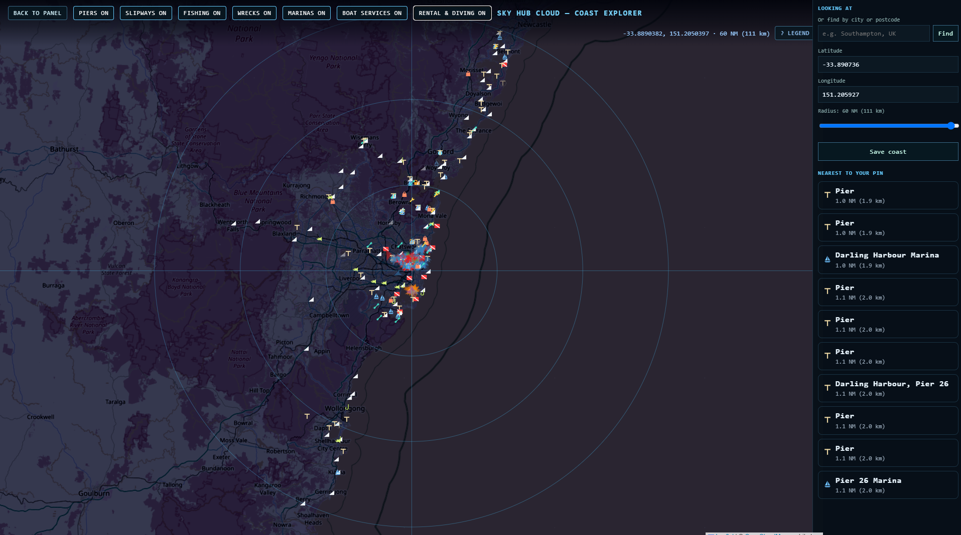
Named boat ramps on our map, by waterway:
| Waterway | Named boat ramps |
|---|---|
| Sydney Harbour and Parramatta River | Woolwich Boat Ramp, Hen and Chicken Bay Boat Ramp, Cabarita boat ramp, Taplin Park Boat Ramp, Burns Bay Boat Ramp |
| Middle Harbour | Tunks Park Boat Ramp |
| Pittwater | Bayview Boat Ramp, Rowland Reserve Boat Ramp (two lanes), Church Point Reserve Boat Ramp |
| Narrabeen Lakes | Bilarong Reserve Boat Ramp, Middle Creek Reserve Boat Ramp |
| Botany Bay | Port Botany Boat Ramp, Kyeemagh Boat Ramp |
| Georges River | Scylla Bay Boat Ramp (Como), Clarendon Boat Ramp, Morgan's Creek Boat Ramp |
| Port Hacking | Gunamatta Bay Boat Ramp, Bundeena Boat Ramp, Grays Point Boat Ramp |
| Hawkesbury and Broken Bay | Patonga Boat Ramp, Dusthole Bay Boat Ramp |
262 more ramps on the map have no name in OpenStreetMap. Turn on the boat ramp layer (the SLIPWAYS button on the map) to see them all.
Sydney Harbour: Darling Harbour, Pyrmont and Balmain
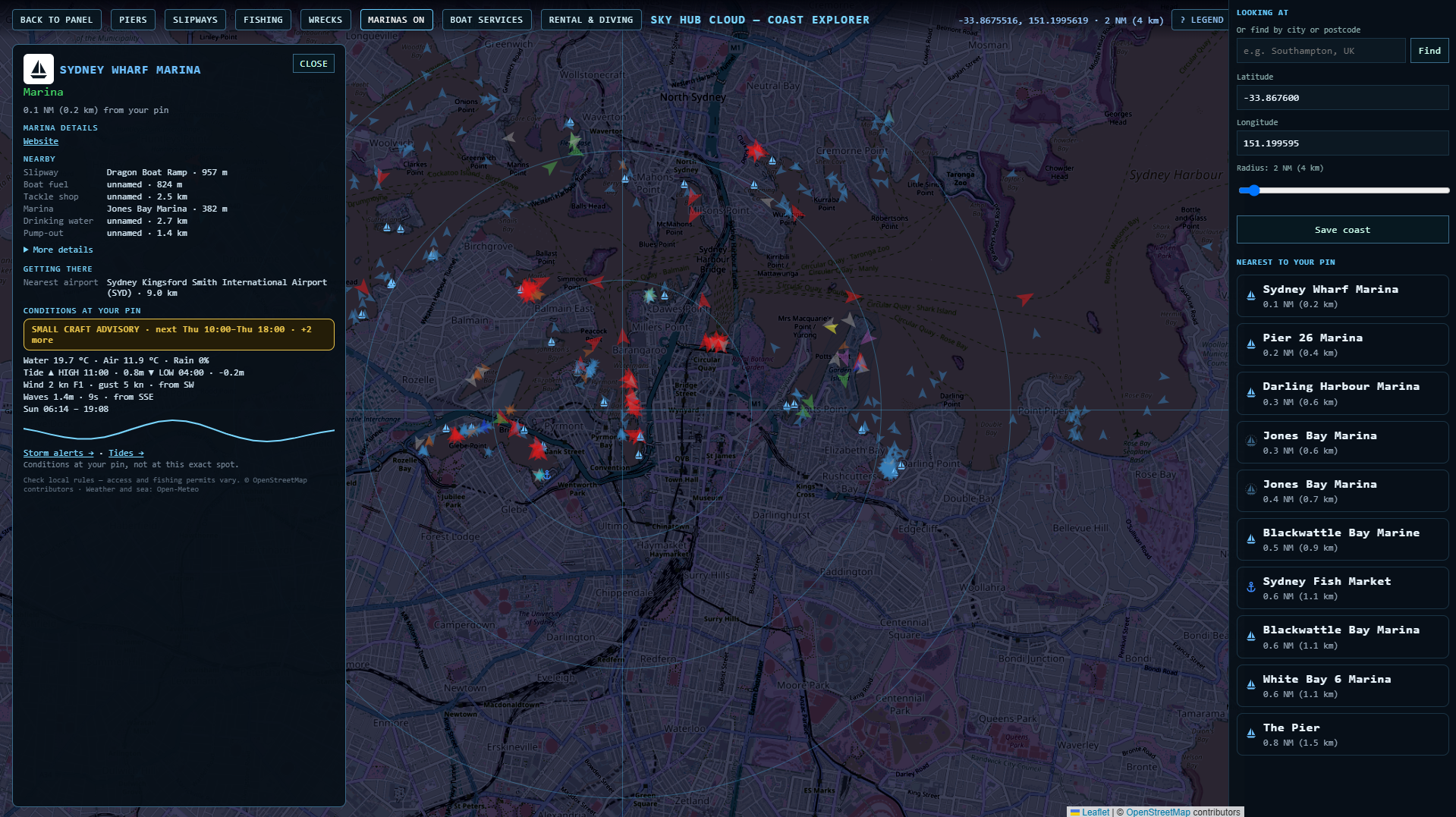
The busiest stretch of water on our Sydney map: Sydney Wharf Marina, Pier 26 Marina, Darling Harbour Marina, Jones Bay Marina, Blackwattle Bay Marina, White Bay 6 Marina and The Pier, with Sydney Fish Market on Blackwattle Bay. From Sydney Wharf Marina the card shows a boat fuel point 824 m away and Sydney Airport (SYD) 9 km away.
Middle Harbour: The Spit and Clontarf
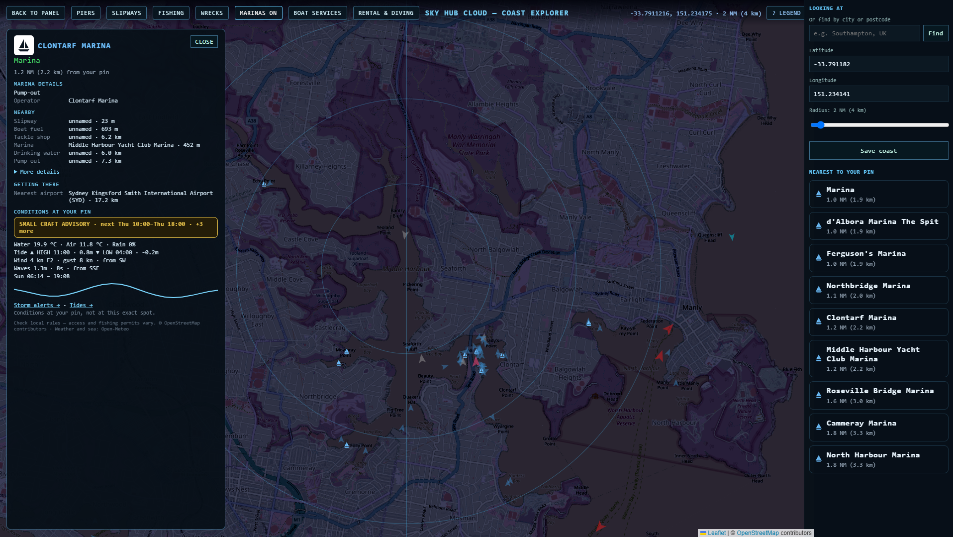
Clontarf Marina has a pump-out, an unnamed boat ramp 23 m away and a boat fuel point 693 m away. Close by: d'Albora Marina The Spit, Ferguson's Marina, Middle Harbour Yacht Club Marina, Northbridge Marina, Roseville Bridge Marina and Cammeray Marina, plus kayak hire at Sydney Harbour Kayaks.
Pittwater: Church Point and Bayview
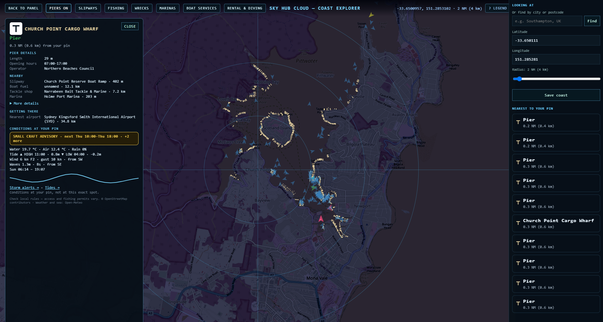
Church Point Cargo Wharf (29 m, open 07:00–17:00, run by Northern Beaches Council), with Church Point Reserve Boat Ramp 402 m away and Holme Port Marina, The Quays, Royal Motor Yacht Club and Gibson Marina nearby. Bayview Boat Ramp and Rowland Reserve Boat Ramp are 2 km south. Some Pittwater ramps are club ramps: one next to the Royal Motor Yacht Club is marked “permit required”. The nearest bait shop is Narrabeen Bait Tackle & Marine.
Botany Bay
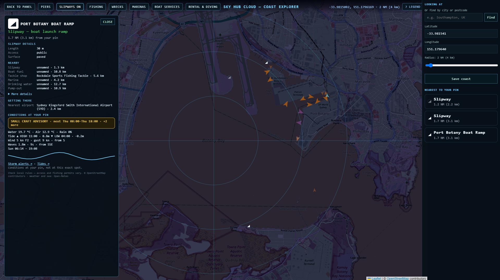
Port Botany Boat Ramp: 30 m, public, paved, 2.4 km from Sydney Airport. Kyeemagh Boat Ramp is on the other side of the bay, and Kamay Wharf La Perouse and Kamay Wharf Kurnell face each other across the entrance. The nearest tackle shop is Rockdale Sports Fishing Tackle.
Port Hacking: Cronulla and Bundeena
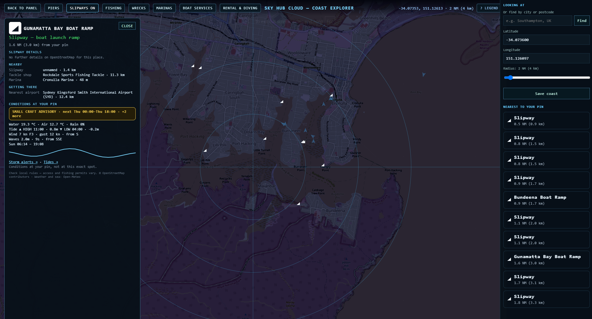
Gunamatta Bay Boat Ramp sits 48 m from Cronulla Marina. Across the water: Bundeena Boat Ramp, Bundeena Wharf and Bundeena Kayaks.
Diving in Sydney
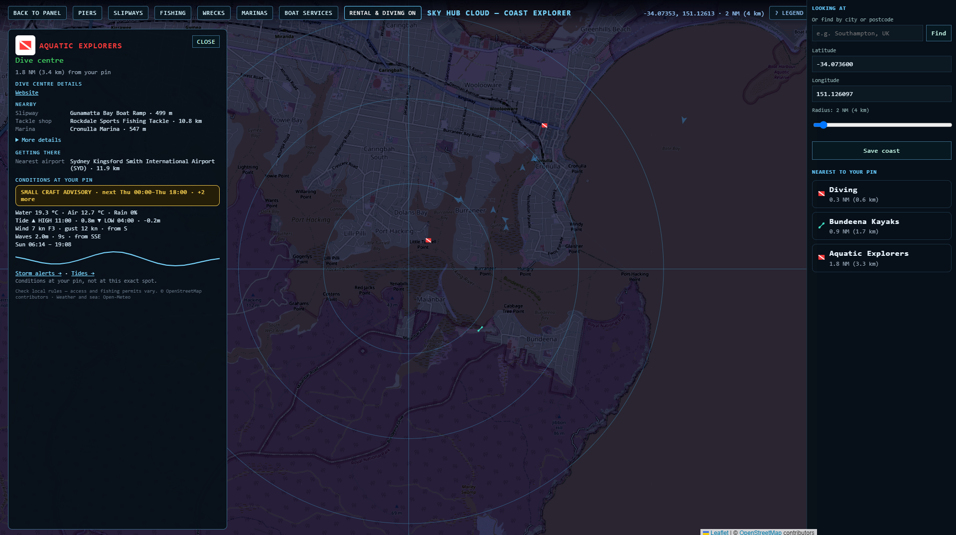
Dive sites on our map include Chowder Bay, Clifton Gardens, Gordons Bay, Blue Fish Wall, The Wall, Waterfall and SS Duckenfield. Dive centres include Dive Centre Manly, Pro Dive, Abyss Scuba Diving, Aquatic Explorers, Plunge and Deep 6.
Wharf fishing in Sydney
Named public jetties, wharves and pontoons on our map include Forty Baskets Jetty, Bantry Bay Jetty, Powder Hulk Bay Public Jetty & Pontoon, Rozelle Bay Public Pontoon, Elizabeth Macarthur Bay Public Pontoon, Swallow Rock Jetty, Morgan's Creek Fishing Jetty and Little Woddy Public Pier. Many other wharves are ferry wharves, so check what is allowed before you cast a line.
Marinas on Sydney Harbour
64 of the 73 marinas on our Sydney map have a name. Among them: Rose Bay Marina, Cruising Yacht Club of Australia Marina, d'Albora Rushcutters Bay Marina, Double Bay Marina, Point Piper Marina, Kirribilli Marina, Neutral Bay Marina, Mosman Bay Marina, Birkenhead Point Marina, Balmain Marina, Woolwich Marina and Cabarita Point Marina.
Bait and tackle shops
Narrabeen Bait Tackle & Marine, Rockdale Sports Fishing Tackle, Big Catch Fishing Tackle, Equipped Fishing Bait & Tackle, Alf's bait shop and Live Bait. Every place card shows the nearest one with its distance.
Before you fish
Sydney has aquatic reserves; the map labels show North Harbour, Cape Banks and Towra Point. Fishing rules there differ from the rest of the harbour, and our map does not show the reserve boundaries, so check NSW fishing rules before you fish.
Tides, wind and waves
At the bottom of every card: storm outlook, water and air temperature, tide times, wind, waves, sunrise and sunset at your pin, from Open-Meteo. Not for navigation.
Questions
Is there a map of Sydney boat ramps?
Yes. Coast Explorer shows 295 boat ramps between Patonga and Port Hacking around your pin, with the nearest marina, boat fuel and tackle shop for each.
Where are the boat ramps on Sydney Harbour?
Named ramps include Woolwich Boat Ramp, Hen and Chicken Bay Boat Ramp, Cabarita boat ramp, Taplin Park Boat Ramp and Tunks Park Boat Ramp in Middle Harbour.
Is there a boat ramp at Clontarf?
Our map shows an unnamed boat ramp 23 m from Clontarf Marina.
Where can I launch a boat on Pittwater?
Bayview Boat Ramp, Rowland Reserve Boat Ramp and Church Point Reserve Boat Ramp. Some club ramps need a permit.
Where can I dive in Sydney?
Chowder Bay, Clifton Gardens, Gordons Bay and Blue Fish Wall are on our map, along with dive centres such as Dive Centre Manly and Pro Dive.
Can I check if a boat ramp is closed today?
Members report closures and changes in one tap, and other members confirm them, so the place card shows what boaters saw recently. Always check on site.
Place data © OpenStreetMap contributors. Weather and sea: Open-Meteo. Not for navigation.
Also on Coast Explorer: Gold Coast → · Malta → · Florida Keys → · Spain →