
 Nederlands Français
Train Radar › Belgium
Live trains in Belgium
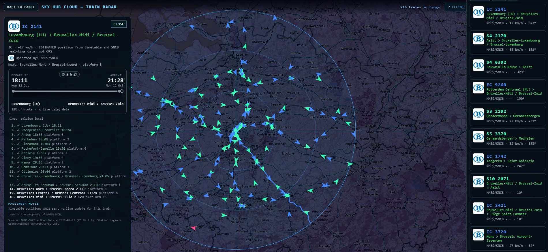
Drop a pin anywhere in Belgium and watch every train within 0.5 to 80 km of it, from the busy North–South junction under Brussels to the lines to Antwerp, Ghent, Liège and Namur. Near the borders you also see the Dutch and French trains. Sky Hub Cloud Train Radar shows what's running around your pin right now, on your TV, desktop or tablet.
What you see on the map
- SNCB / NMBS trains, each drawn as an arrow pointing where it is heading
- Zoom in and the arrow becomes the whole train, drawn along the track
- Colours for each kind of train, explained in the legend
- Click a train and its route is drawn on the map
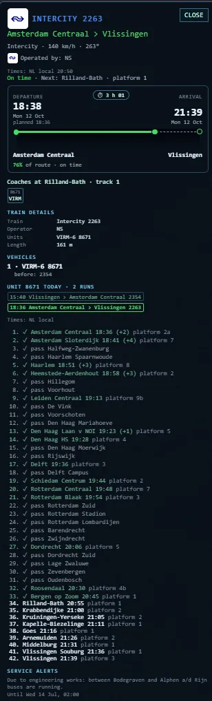
- Near the borders, the Dutch NS trains (from GPS) and the French TER trains as well
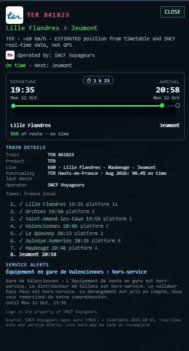
What the train card shows
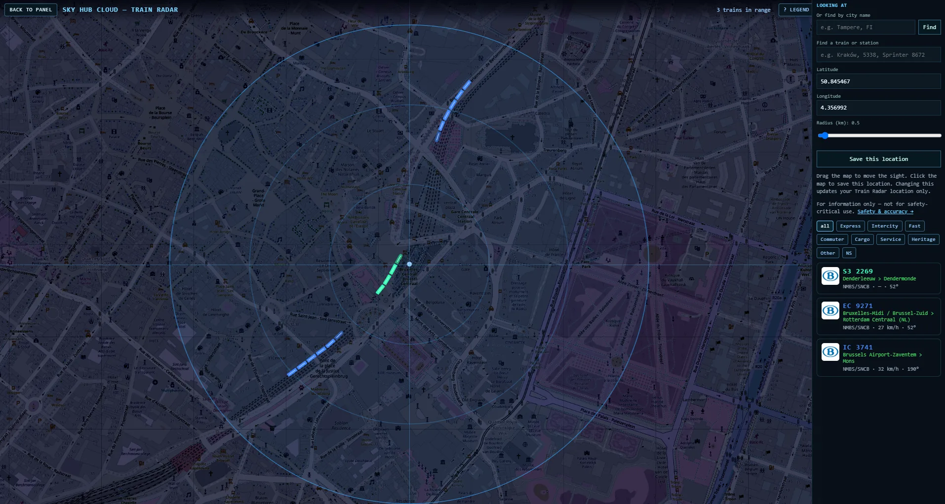
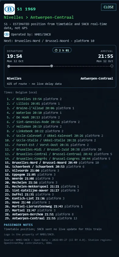
- The train category: InterCity (IC), local (L), suburban (S1 to S62), EuroCity (EC) and peak trains (P)
- Where it comes from and where it is going, including stations abroad such as Rotterdam Centraal
- Every stop with its time and platform
- Station names in the language of the region: Dutch in Flanders, French in Wallonia, both in Brussels (for example Bruxelles-Midi / Brussel-Zuid)
- The delay, when SNCB sends a live update for the train
- Times in Belgian local time
How positions work in Belgium
SNCB does not publish GPS positions. Sky Hub Cloud estimates where each train is from the timetable and SNCB's real-time data, and the card says so. SNCB sends live updates only for trains that run differently from the timetable; a train without an update follows the timetable, and its card tells you that no live update has arrived.
Where the data comes from
NMBS-SNCB Open Data (CC BY 4.0). Station regions: OpenStreetMap contributors (ODbL).
Beyond a journey planner
- Your own pin and radius, from 0.5 km at a platform to 80 km across a region
- TRAIN LOG: statistics for your spot, CSV download and a weekly report
- The same plan includes Fly Radar and Ship Radar with Coast Explorer, so the coast at Ostend and Zeebrugge also shows ships and the planes over it
Good places to drop a pin
- Bruxelles-Central / Brussel-Centraal: the North–South junction, where trains from all over the country cross under the city
- Bruxelles-Midi / Brussel-Zuid: the international station, with InterCity and EuroCity trains
- Antwerpen-Centraal: one of the most famous stations in Europe, on two levels
- Gent-Sint-Pieters: the main station of Flanders' second city
- Liège-Guillemins: the east, on the line to Germany
- Namur: the south, on the lines along the Meuse
Questions
Is it GPS?
No, positions are estimated from the timetable and SNCB's real-time data.
Why do some stations have two names?
In Brussels both French and Dutch names are official, so the card shows both.
Can I see delays?
When SNCB sends a live update for the train. Trains without one follow the timetable, and the card says so.
Do I see Dutch and French trains too?
Yes, near the borders the NS and SNCF TER trains appear as well.
Does it work on a TV?
Yes, it is built for big screens: TV, desktop or tablet. It works on a phone too.