
 DeutschFrançais
Train Radar / Mountain railways Switzerland
356 CABLE CARS. 49 FUNICULARS. 15 MOUNTAIN RAILWAYS. ONE PIN.
Switzerland has mountain railways, steam lines and more cable cars than anywhere else on our map. Sky Hub Cloud Train Explorer puts them on one map around your pin. Drop the pin where you are, or type a town, and you see every railway, cable car, funicular and railway museum within reach.
Our map of Switzerland has 15 mountain and heritage railways with 512 km of route and 192 stations, plus 356 cable cars and gondolas, 49 funiculars, 21 railway museums and 5 old engine sheds. 129 of the 192 stations have a postcode, so the satnav finds them.
Glacier Express: 286 km and 82 stations
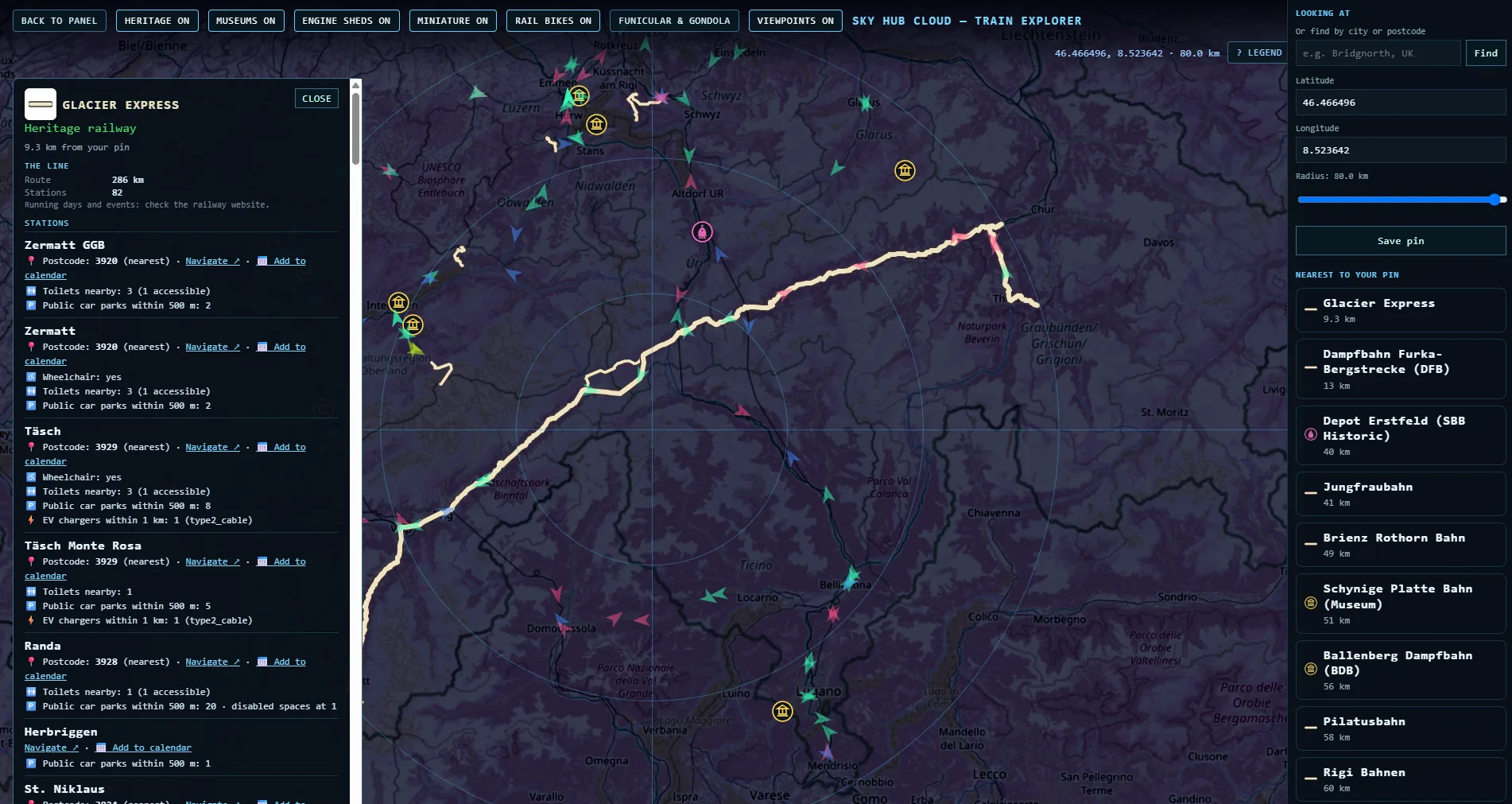
The Glacier Express is the longest line on our map of Switzerland, 286 km with 82 stations from Zermatt to the east. Tap the line and the card lists every station with what the map knows. Zermatt has a postcode, wheelchair access and toilets nearby. Täsch has 8 public car parks within 500 metres and an EV charger.
The Bernese Oberland: one pin, hundreds of cable cars
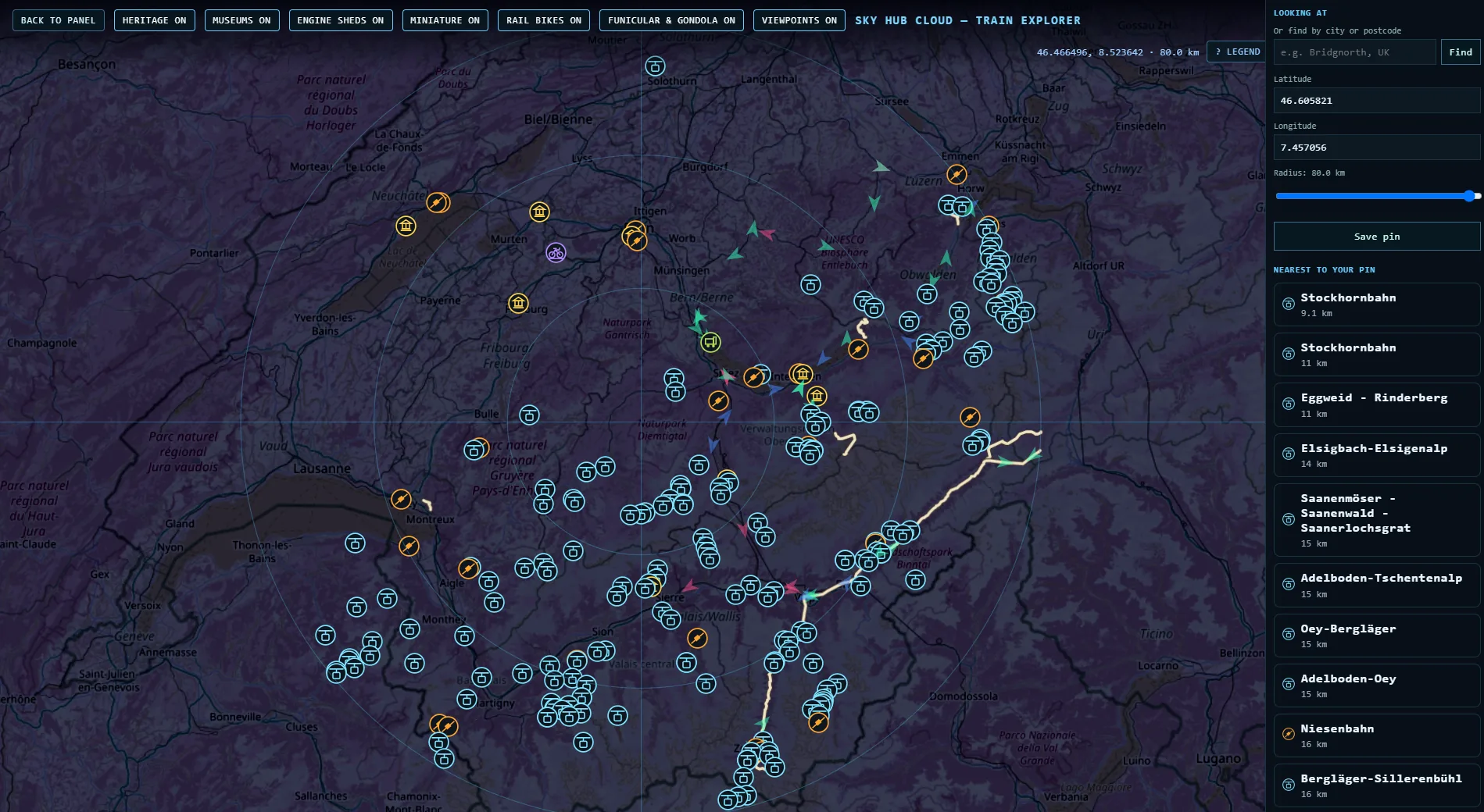
Put your pin near Thun and the map fills with cable cars and funiculars. The Stockhornbahn is 9 km away and the Niesenbahn 16 km. The Jungfraubahn, the Brienz Rothorn Bahn and the Schynige Platte museum line are all within reach, and Lake Thun has its own small steam railway at Schadaupark.
Rigi, Pilatus and Lake Lucerne
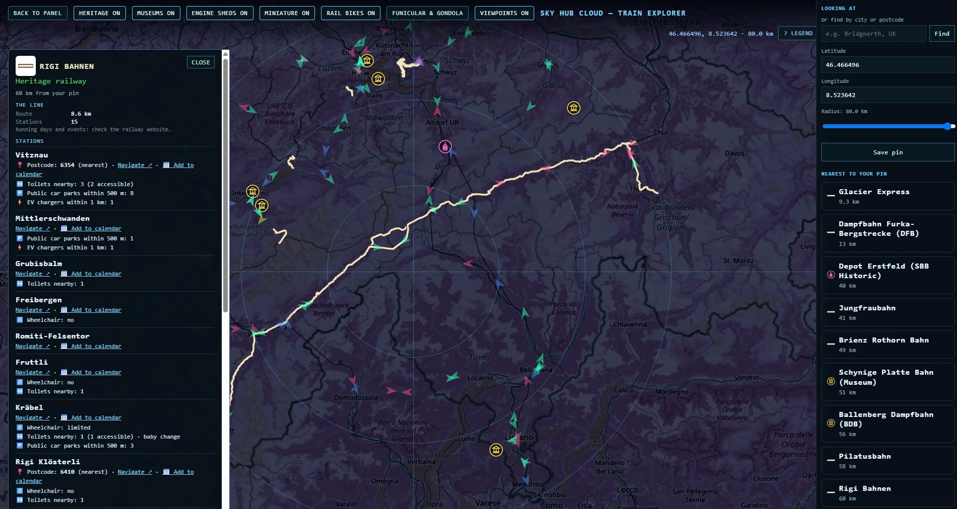
Rigi Bahnen has 15 stations on our map, from Vitznau on the lake up the mountain. Vitznau has 8 car parks, 3 toilets nearby (2 of them accessible) and an EV charger. The Pilatusbahn climbs from Alpnachstad to Pilatus Kulm with 4 stations.
Steam in the mountains
The Dampfbahn Furka-Bergstrecke runs 18 km with 7 stations from Oberwald over the Furka. The Dampfbahn-Verein Zürcher Oberland runs 11 km from Hinwil to Bauma. The Bernina Express covers 142 km with 45 stations.
Railway museums and engine sheds
The map has 21 railway museums, including Locorama in Romanshorn, Bahnmuseum Albula, Bahnpark Brugg and the tram museums in Zürich, Bern and Basel. 5 old engine sheds are on it too, among them Depot Erstfeld of SBB Historic and the Rotonde de Delémont.
Before you go: postcodes, parking and access
Every station card shows only what the map says, nothing more. In Switzerland that means a postcode for 129 of 192 stations, public parking near 145, toilets near 115, EV chargers near 74 and wheelchair details for 72. Navigate opens Google Maps with directions to the station.
All mountain and heritage railways in Switzerland
| Railway | km | Stations |
|---|---|---|
| Glacier Express | 286.4 | 82 |
| Bernina Express | 141.9 | 45 |
| Dampfbahn Furka-Bergstrecke (DFB) | 17.7 | 7 |
| Dampfbahn-Verein Zürcher Oberland (DVZO) | 11.4 | 5 |
| Rheinbähnle (Internationale Rheinregulierungsbahn) | 9.8 | 6 |
| Gornergrat Bahn | 9.4 | 9 |
| Jungfraubahn | 9.3 | 5 |
| Rigi Bahnen | 8.6 | 15 |
| Brienz Rothorn Bahn | 7.6 | 4 |
| Pilatusbahn | 4.3 | 4 |
| Chemin de fer-musée Blonay-Chamby | 2.9 | 6 |
| Petit train panoramique d'Émosson | 1.6 | 2 |
| Schinznacher Baumschulbahn | 0.7 | 2 |
| Vapeur Val-de-Travers | 0 | |
| Zürcher Museums-Bahn | 0 |
Kilometres are measured along the line on our map. A blank means the line is not drawn on our map yet.
Questions
How many mountain railways and cable cars are there in Switzerland?
Our map shows 15 mountain and heritage railways, 356 cable cars and gondolas and 49 funiculars.
What is the longest heritage railway in Switzerland?
On our map, the Glacier Express, 286 km with 82 stations.
How do I find a mountain railway near me?
Drop your pin or type a town in Train Explorer and every railway, cable car and museum around your pin appears on the map.
Can I get directions to a station?
Yes. Navigate on every station card opens Google Maps with directions.
Can I charge my electric car at a mountain railway?
The card shows EV chargers within 1 km where the map has them. In Switzerland that is 74 of 192 stations.
Data: OpenStreetMap contributors (ODbL), Wikidata (CC0). Postcodes from OpenStreetMap.