Fly Radar › ISS Tracker · Last updated: 17 October 2026
ISS Tracker: the Space Station and the planes over your pin
Sky Hub Cloud shows the International Space Station from your own pin: when it will be visible, exactly where to look, whether the sky will be clear enough, and which planes are in the same patch of sky while it passes.
Your pin is the place you set once in your Control Panel. The ISS card, Fly Radar, Ship Radar, Train Radar and Coast Explorer all use the same pin, so you never type your location twice.
What the ISS card shows
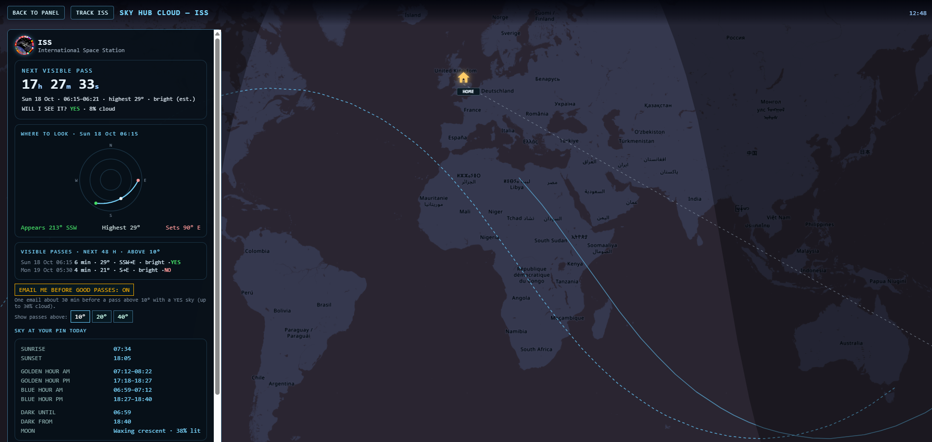
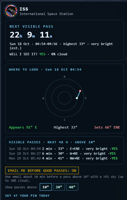
- Next visible pass: a live countdown, the time window, how high the station climbs and an estimate of how bright it will be.
- Where to look: a sky chart with the station's path: where it appears, its highest point, and where it sets or fades into Earth's shadow.
- Will I see it? YES / MAYBE / NO: the forecast cloud cover for your pin at pass time from MET Norway. YES up to 30% cloud, MAYBE 30–70%, NO above 70%.
- Visible passes in the next 48 hours, with a setting for 10°, 20° or 40° above the horizon.
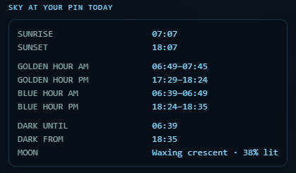
- Sky at your pin today: sunrise, sunset, golden and blue hours, when it gets dark and the Moon's phase.
- Details: altitude, speed, whether the station is in sunlight or in Earth's shadow, its distance from your pin, the crew on board and how fresh the orbit data is.
- Next rocket launch with a countdown.
- Live map: where the ISS is now, its track over the Earth and the day–night line.
An email before good passes
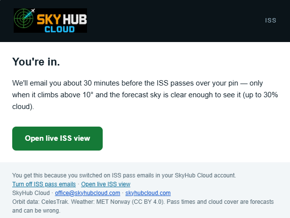
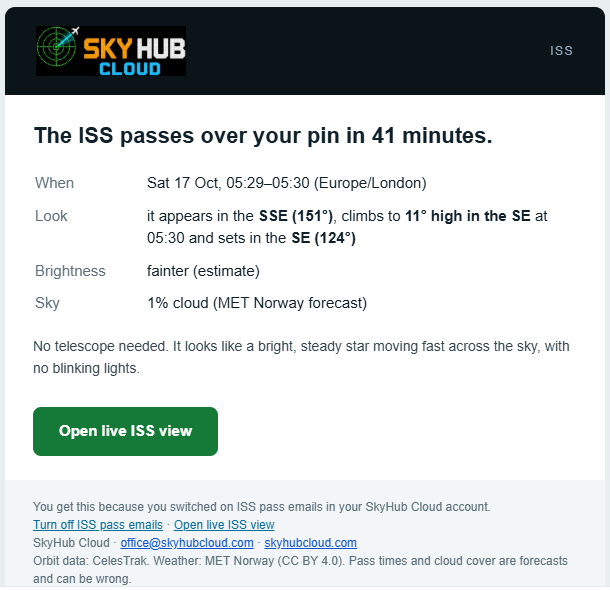
Switch on one button and we email you before a pass that climbs above your setting with a YES sky. The email arrives roughly half an hour before the pass. In practice that is usually 30–45 minutes, so you have time to get outside. One click in the email turns it off.
The ISS and the planes, on one sky
While the ISS is visible over your pin, the sky chart also shows the planes within 30 km of your pin, with their callsigns, refreshed every 5 seconds, and a blue dot that marks where the station is right now.
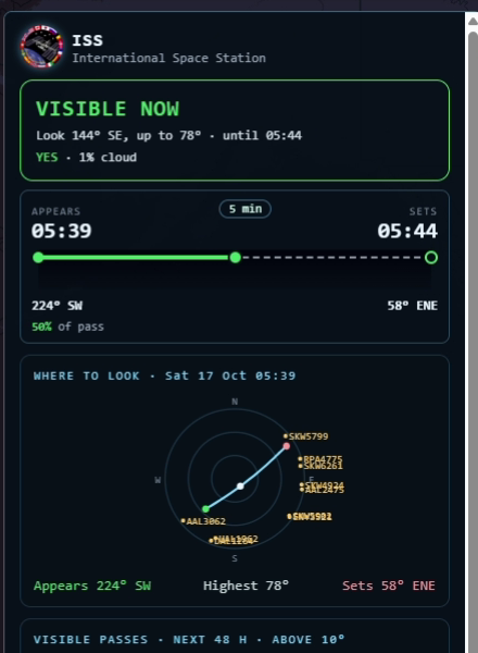
If a plane is about to line up with the ISS, it turns green and the card says so, for example "BAW123 crosses the ISS in 40 s" or "BAW123 passes close to the ISS in 40 s · about 1.4° apart". We use the same method that trackers use for planes crossing the Moon: each plane is moved forward along its course and speed, second by second, and compared with the station's path.
To be honest about the limits: this is a forecast for the next minute or two, not hours. A plane's height comes from its own transponder, so its place on the chart is accurate to about one degree. Only planes that broadcast ADS-B are shown.
Is that the ISS or a plane?
The ISS is a steady white light. It does not blink and has no coloured lights. It crosses the sky smoothly in a few minutes, never turns, and often fades out gradually as it enters Earth's shadow. A plane usually blinks, moves more slowly and can turn. On the card you don't need to guess: the station and the planes are drawn on the same sky, with names.
Where on Earth can you see the ISS?
The station's orbit is tilted 51.6° to the equator, so how high it can climb depends on how far north or south you are. Measured on the real orbit over 60 days:
| Pin | Highest the ISS climbs |
|---|---|
| Manchester | about 65° |
| Edinburgh | about 40° |
| Oslo / Helsinki | about 20° |
| Reykjavik | about 11° |
| Tromsø | about 3° |
| Antarctica (McMurdo) | never above the horizon |
The same applies in the far south. If your setting is higher than the station can reach from your pin, the card tells you straight away, instead of just saying "not tonight".
How we work it out
We take the station's orbit data from CelesTrak every two hours and work out the passes right in your browser. We checked our pass times against Skyfield, a standard astronomy library, on 82 passes over 12 cities: all within 3 seconds. We are now measuring our accuracy against NASA's own ISS trajectory and will publish the result here once it is measured.
Built for big screens: your TV, desktop or tablet. Works on a phone too.
Questions
How do I know when the ISS will be visible from my location?
Set your pin once in the Control Panel. The ISS card shows the next visible pass with a countdown and the next 48 hours.
Why can't I see the ISS tonight?
It is only visible when your sky is dark and the station is still in sunlight, usually around dusk and dawn. Some nights have no such pass. Far north or south, it may never climb high enough, and the card tells you so.
What does the ISS look like?
A bright, steady white light moving smoothly across the sky in a few minutes, with no blinking.
Can I see which planes are near the ISS?
Yes. During a visible pass the card shows the planes within 30 km of your pin on the same sky chart, with callsigns, and highlights any plane that will cross or pass close to the ISS.
Do I need a telescope?
No. The ISS is easy to see with the naked eye.
Orbit data: CelesTrak · Weather: MET Norway (CC BY 4.0) · Launches and crew: The Space Devs · Maps: © OpenStreetMap contributors