
Fly Radar › Flight Tracker · Last updated: 24 October 2026
Sky Hub Cloud Flight Tracker: follow one flight, take-off to landing
Type the flight number from your ticket, or press TRACK FLIGHT on any aircraft in Fly Radar. The tracker follows that one aircraft anywhere in the world, updates every five seconds, and keeps the flight for two hours after it lands.
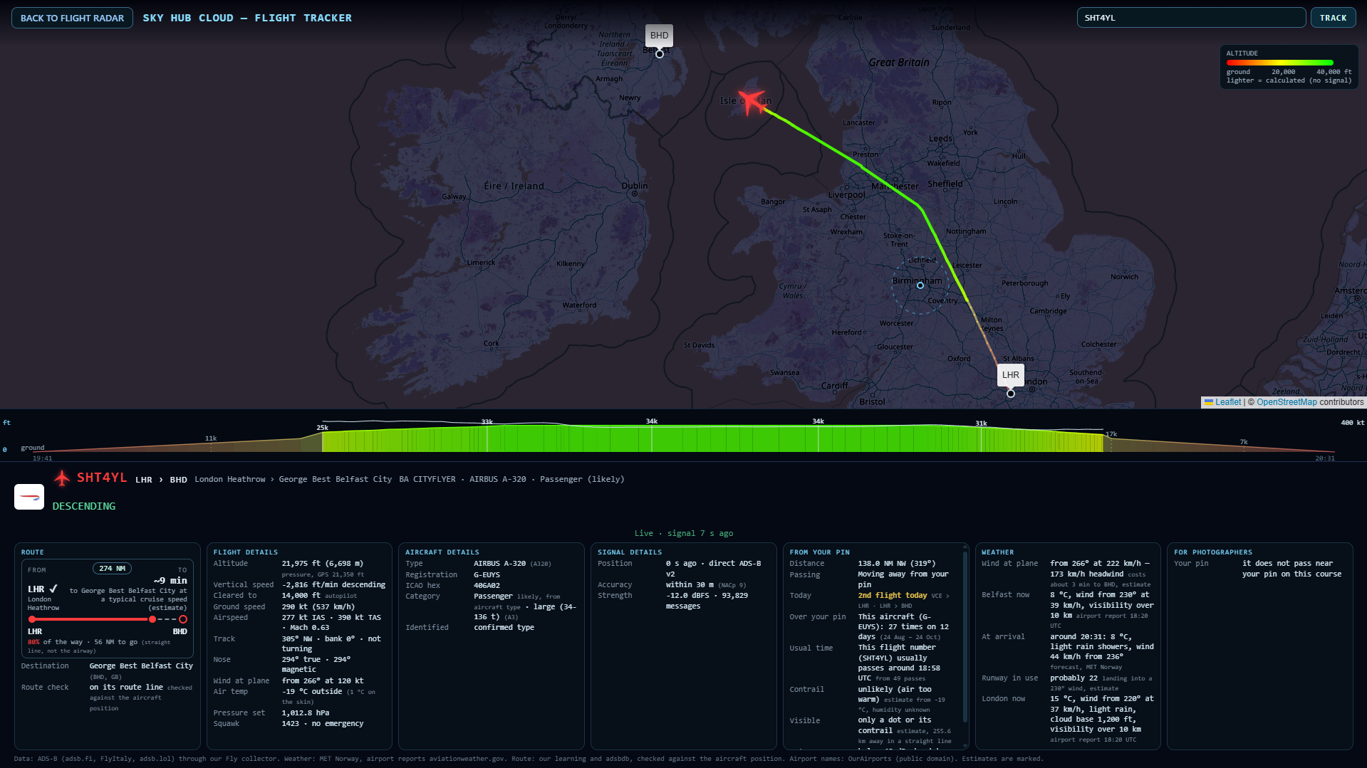
The number on your ticket is not always the one the plane sends
Airlines often fly under a different callsign than the ticket: a British Airways ticket can fly as a BA CityFlyer callsign, an easyJet ticket as EZY. Sky Hub Cloud looks the flight up both ways. If it cannot find the ticket number in the air, it lists the airline’s flights it knows on that route, so you pick yours. Your pick is remembered on that device for the day. You can also search by callsign or registration.
A line from the departure airport, coloured by height
The line runs through the real positions the aircraft sent. If we joined the flight after take-off, or the signal dropped for a while, the missing part is calculated from the aircraft’s course and drawn lighter, so you always see real from estimated. The colour follows the height on one fixed scale: red near the ground, green at 40,000 ft.
The whole flight as one chart
Under the map, the flight is drawn as a wave from take-off to landing: climb, cruise and descent, with the height marked eight times along the route and the speed as a thin line. Move along the chart and a dot shows that moment on the line. The part still to fly is shown lighter as a forecast.

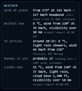
Weather when it lands
WEATHER shows the wind at the aircraft and whether it is a tailwind or a headwind, with the minutes it saves or costs. It shows the destination airport now, from the airport’s own weather report, the forecast for the time of arrival, the runway probably in use and the weather at the departure airport.
The aircraft’s day
The card shows which flight of the day this is for the aircraft and the legs it has flown today, for example Venice to London and London to Belfast. Under it, the same card as Fly Radar: route, flight details, aircraft and signal.
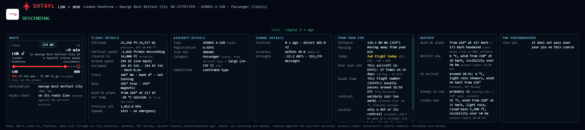
Honest about the signal
If the last position is more than 30 seconds old, the tracker says so and shows the position estimated from course and speed. If the aircraft leaves the coverage of our ADS-B sources, it says that too and keeps looking.
For plane spotters
When the flight passes closest to your pin, where the sun will be, the cloud, the runway in use and the lens you need: Plane spotting →
Frequently asked questions
Can I track a flight with the number on my ticket?
Yes. Type it as it is on the ticket, for example BA 123. If the aircraft flies under another callsign, we show the airline’s flights on that route and you pick yours.
Why is part of the line lighter?
That part is calculated, not received: before we joined the flight, or while the signal was lost. Real positions are drawn solid.
Will it show the weather when my flight lands?
Yes: the destination airport now, the forecast for the arrival time and the runway probably in use.
How you get it
Try everything in the free 60-minute demo, no card. Paid plans start at £8.99 a month and include Fly Radar, Flight Tracker, Ship Radar, Train Radar and Coast Explorer on one pin. Try it free · Plans
Questions: office@skyhubcloud.com.