
 Version française
Train Radar / Tourist railways France
44 TOURIST RAILWAYS. 874 KM. 218 CABLE CARS. ONE PIN.
France has tourist trains in the Alps, the Pyrenees, Corsica and along the coast, and more than 200 cable cars in the mountains. Sky Hub Cloud Train Explorer puts them on one map around your pin. Drop the pin where you are, or type a town, and you see every tourist railway, cable car, funicular, rail bike and railway museum within reach.
Our map of France has 44 tourist and mountain railways with 874 km of route and 284 stations, plus 218 cable cars, 24 funiculars, 24 rail bike routes, 25 railway museums and 7 old roundhouses.
Chamonix and Mont Blanc
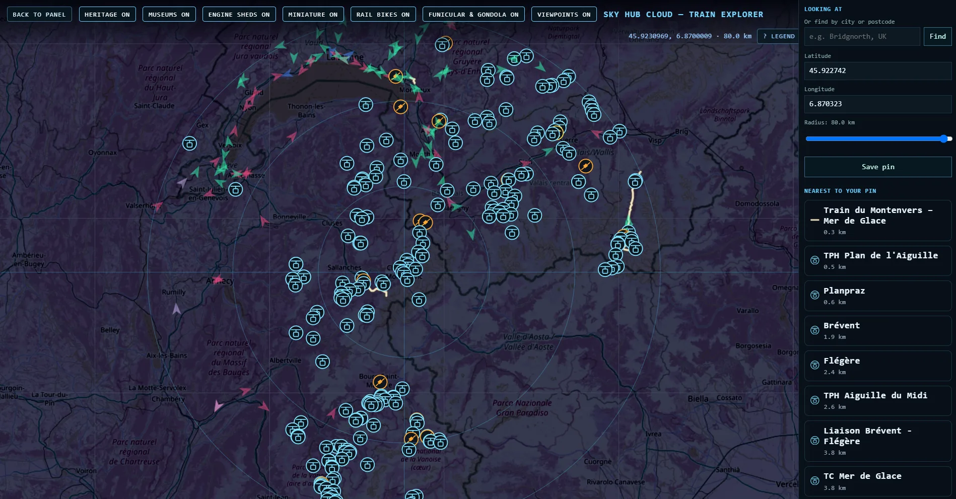
Put your pin in Chamonix and the map fills with cable cars. The Train du Montenvers to the Mer de Glace starts 300 metres away. The Aiguille du Midi, Plan de l’Aiguille, Brévent and Flégère cable cars are all within 3 km, and the Tramway du Mont-Blanc runs 12 km with 8 stations on the slopes of Mont Blanc.
Train du Montenvers: what the card shows
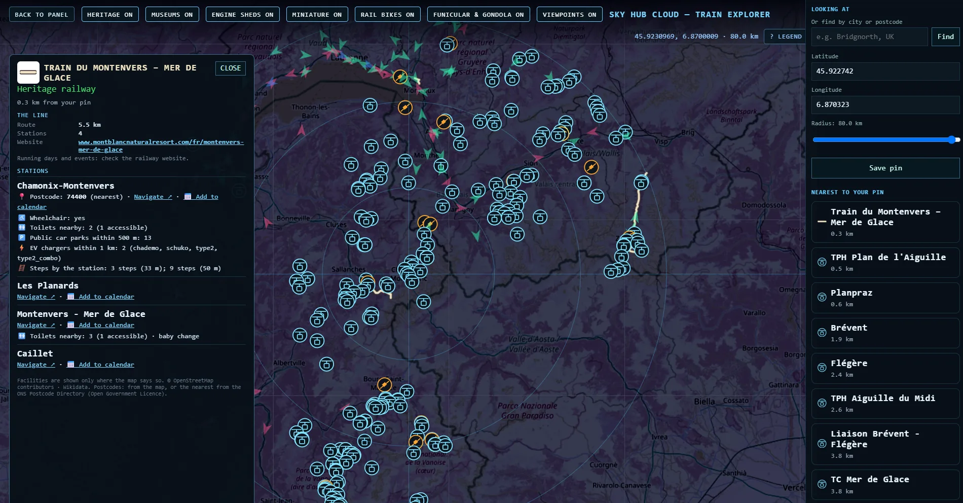
The Train du Montenvers runs 5.5 km with 4 stations up to the Mer de Glace. Chamonix-Montenvers station has its postcode, wheelchair access, 2 toilets with one accessible, 13 public car parks within 500 metres, and 2 EV chargers within 1 km with their plug types.
Corsica, Provence and the Pyrenees
The Chemins de fer de la Corse are the longest line on our map of France, 184 km with 65 stations. The Chemins de Fer de Provence run 107 km with 41 stations from Nice into the mountains. In the Pyrenees the Train Jaune covers 63 km with 22 stations, and the Train de la Rhune climbs to the summit of La Rhune.
Steam and tourist trains across France
The Chemin de fer de la Baie de Somme has 12 stations on our map. The Train à Vapeur des Cévennes runs from Anduze to Saint-Jean-du-Gard, Le Mastrou runs 28 km in the Ardèche and the Velay Express 27 km. Rail bikes run on 24 old lines, from the Vélorail de la Sioule to the Vélo-Rails of Étretat.
Railway museums and roundhouses
The map has 25 railway museums, including the Cité du Train in Mulhouse and the Musée Vivant du Chemin de Fer of AJECTA, and 7 old roundhouses, among them the Rotonde de la Villette in Paris and the Rotondes de Mohon.
Before you go: postcodes, parking and access
Every station card shows only what the map says, nothing more. In France that means public parking near 221 of 284 stations, EV chargers near 109, toilets near 98, a postcode for 89 and wheelchair details for 61. Navigate opens Google Maps with directions to the station.
All tourist railways in France
Kilometres are measured along the line on our map. A blank means the line is not drawn on our map yet.
Questions
How many tourist railways are there in France?
Our map shows 44 tourist and mountain railways with 874 km of route, plus 218 cable cars and 24 rail bike routes.
What is the longest tourist railway in France?
On our map, the Chemins de fer de la Corse, 184 km with 65 stations.
How do I find a tourist train near me?
Drop your pin or type a town in Train Explorer and every railway, cable car and museum around your pin appears on the map.
Can I get directions to a station?
Yes. Navigate on every station card opens Google Maps with directions.
Can I charge my electric car at a tourist railway?
The card shows EV chargers within 1 km where the map has them. In France that is 109 of 284 stations.
Data: OpenStreetMap contributors (ODbL), Wikidata (CC0). Postcodes from OpenStreetMap.